Pantelleria geodata
Pantelleria (Sicily) is a seat of a third-order administrative division; located in Italy in Europe/Rome (GMT+2) time zone. With population of 3,455 people, there are 2714 cities with bigger population in this country. Compared to other cities in Italy, 99.9% of cities are located further ↑North; 55.2% of cities are located further ←West and 81.5% of cities have higher elevation than Pantelleria. Note1


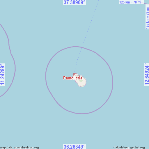
Pantelleria GPS coordinates[2]
36° 49' 42.096" North, 11° 56' 45.996" East
| Map corner | latitude | longitude |
|---|---|---|
| Upper-left | 37.38909°, | 11.24299° |
| Center: | 36.82836°, | 11.94611° |
| Lower-right: | 36.26349°, | 12.64924° |
| Map W x H: | 125.2×125.2 km | = 77.8×77.8mi |
| max Lat: | 47.04031° ⇑99.9% North |
| Pantelleria: | 36.82836° |
| min Lat: | ⇓0.1% South 35.50142° |
| min Long | Pantelleria | max Long |
| 6.69888° | 11.94611° | 18.48682° |
| W 55.2%⇐ | ⇒44.8% E |
Elevation
Elevation of Pantelleria is 44 m = 144 ft, and this is 262.7 m = 862 ft below average elevation for this country.
| Max E: |
2085 m = 6841 ft | 81.5% |
| Avg. | 306.7 m = 1006 ft | |
| Pantelleria | 44 m = 144 ft | |
Min E: |
-4 m = -13 ft | 18.5% |
See also: Italy elevation on elevation.city.
Geographical zone
Pantelleria is located in North temperate zone (between Tropic of Cancer and the Arctic Circle). Distance of this Northern Tropic circle is 1489 km =925.2 mi to South.| Distance of | km | miles | from Pantelleria |
|---|---|---|---|
| North Pole | 5912.1 | 3673.6 | to North |
| Arctic Circle | 3306.2 | 2054.4 | to North |
| Tropic Cancer | 1489 | 925.2 | to South |
| Equator | 4094.9 | 2544.5 | to South |


Nearby cities:
15 places around Pantelleria: (largest is in red/bold)
• Campobello di Mazara
114.4 km =71.1 mi,  38°
38°
• Castelvetrano
120.8 km =75.1 mi, 38°
• Ciavolo
118 km =73.3 mi,  26°
26°
• Favignana
127 km =78.9 mi,  15°
15°
• Kamma
8.7 km =5.4 mi,  113°
113°
• Marinella
116.6 km =72.5 mi, 43°
• Marsala
116.3 km =72.3 mi, 21°
• Mazara II
111.1 km =69 mi, 31°
• Mazara del Vallo
108.2 km =67.2 mi, 31°
• Menfi
125.1 km =77.7 mi,  46°
46°
• Petrosino
109.9 km =68.3 mi, 26°
• Scauri
8.3 km =5.2 mi,  154°
154°
• Sciacca
125.9 km =78.2 mi, 53°
• Tre Fontane
107.5 km =66.8 mi, 39°
• Triscina
112.7 km =70 mi, 41°
Sources, notices
• [Note1] Compared only with cities in Italy existing in our database
• [Src1] Map data: © OpenStreetMap contributors (CC-BY-SA)
• [Src2] Other city data from geonames.org with taken over terms of usage.
• [Src3] Geographical zone / Annual Mean Temperature by Robert A. Rohde @ Wikipedia
