Kamma geodata
Kamma (Sicily) is a populated place; located in Italy in Europe/Rome (GMT+2) time zone. With population of 1,206 people, there are 5940 cities with bigger population in this country. Compared to other cities in Italy, 99.9% of cities are located further ↑North; 56.4% of cities are located further ←West and 57% of cities have higher elevation than Kamma. Note1


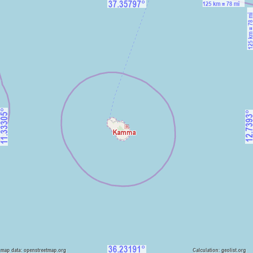
Kamma GPS coordinates[2]
36° 47' 49.236" North, 12° 2' 10.212" East
| Map corner | latitude | longitude |
|---|---|---|
| Upper-left | 37.35797°, | 11.33305° |
| Center: | 36.79701°, | 12.03617° |
| Lower-right: | 36.23191°, | 12.7393° |
| Map W x H: | 125.2×125.2 km | = 77.8×77.8mi |
| max Lat: | 47.04031° ⇑99.9% North |
| Kamma: | 36.79701° |
| min Lat: | ⇓0.1% South 35.50142° |
| min Long | Kamma | max Long |
| 6.69888° | 12.03617° | 18.48682° |
| W 56.4%⇐ | ⇒43.6% E |
Elevation
Elevation of Kamma is 188 m = 617 ft, and this is 118.7 m = 389 ft below average elevation for this country.
| Max E: |
2085 m = 6841 ft | 57% |
| Avg. | 306.7 m = 1006 ft | |
| Kamma | 188 m = 617 ft | |
Min E: |
-4 m = -13 ft | 43% |
See also: Italy elevation on elevation.city.
Geographical zone
Kamma is located in North temperate zone (between Tropic of Cancer and the Arctic Circle). Distance of this Northern Tropic circle is 1485.5 km =923 mi to South.| Distance of | km | miles | from Kamma |
|---|---|---|---|
| North Pole | 5915.6 | 3675.8 | to North |
| Arctic Circle | 3309.7 | 2056.6 | to North |
| Tropic Cancer | 1485.5 | 923 | to South |
| Equator | 4091.4 | 2542.3 | to South |


Nearby cities:
15 places around Kamma: (largest is in red/bold)
• Campobello di Mazara
112.5 km =69.9 mi,  34°
34°
• Castelvetrano
118.9 km =73.9 mi, 34°
• Ciavolo
117.9 km =73.3 mi,  22°
22°
• Marinella
114 km =70.8 mi,  38°
38°
• Marsala
116.9 km =72.6 mi, 17°
• Mazara II
110.3 km =68.5 mi, 26°
• Mazara del Vallo
107.3 km =66.7 mi, 27°
• Menfi
122 km =75.8 mi, 42°
• Pantelleria
8.7 km =5.4 mi,  293°
293°
• Partanna
128 km =79.5 mi, 36°
• Petrosino
109.8 km =68.2 mi, 21°
• Scauri
6 km =3.7 mi,  227°
227°
• Sciacca
121.9 km =75.7 mi,  49°
49°
• Tre Fontane
105.4 km =65.5 mi, 35°
• Triscina
110.3 km =68.5 mi, 37°
Sources, notices
• [Note1] Compared only with cities in Italy existing in our database
• [Src1] Map data: © OpenStreetMap contributors (CC-BY-SA)
• [Src2] Other city data from geonames.org with taken over terms of usage.
• [Src3] Geographical zone / Annual Mean Temperature by Robert A. Rohde @ Wikipedia
