Melicuccà geodata
Melicuccà (Calabria) is a populated place; located in Italy in Europe/Rome (GMT+2) time zone. With population of 561 people, there are 9339 cities with bigger population in this country. Compared to other cities in Italy, 94% of cities are located further ↑North; 94.1% of cities are located further ←West and 59.3% of cities have lower elevation than Melicuccà. Note1


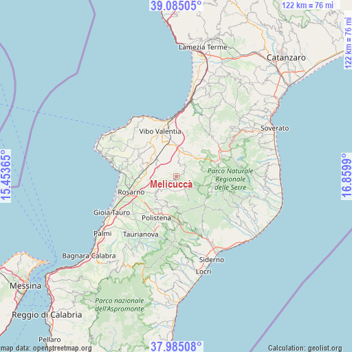
Melicuccà GPS coordinates[2]
38° 32' 13.812" North, 16° 9' 24.372" East
| Map corner | latitude | longitude |
|---|---|---|
| Upper-left | 39.08505°, | 15.45365° |
| Center: | 38.53717°, | 16.15677° |
| Lower-right: | 37.98508°, | 16.8599° |
| Map W x H: | 122.3×122.3 km | = 76×76mi |
| max Lat: | 47.04031° ⇑94% North |
| Melicuccà: | 38.53717° |
| min Lat: | ⇓6% South 35.50142° |
| min Long | Melicuccà | max Long |
| 6.69888° | 16.15677° | 18.48682° |
| W 94.1%⇐ | ⇒5.9% E |
Elevation
Elevation of Melicuccà is 294 m = 965 ft, and this is 12.7 m = 42 ft below average elevation for this country.
| Max E: |
2085 m = 6841 ft | 40.7% |
| Avg. | 306.7 m = 1006 ft | |
| Melicuccà | 294 m = 965 ft | |
Min E: |
-4 m = -13 ft | 59.3% |
See also: Italy elevation on elevation.city.
Geographical zone
Melicuccà is located in North temperate zone (between Tropic of Cancer and the Arctic Circle). Distance of this Northern Tropic circle is 1679 km =1043.3 mi to South.| Distance of | km | miles | from Melicuccà |
|---|---|---|---|
| North Pole | 5722.1 | 3555.5 | to North |
| Arctic Circle | 3116.2 | 1936.3 | to North |
| Tropic Cancer | 1679 | 1043.3 | to South |
| Equator | 4284.9 | 2662.5 | to South |


Nearby cities:
15 places around Melicuccà: (largest is in red/bold)
• Acquaro
3.5 km =2.2 mi,  50°
50°
• Arena
5.5 km =3.4 mi,  59°
59°
• Candidoni
7.1 km =4.4 mi,  240°
240°
• Dasà
4.6 km =2.9 mi, 47°
• Dinami
1.2 km =0.7 mi, 238°
• Francica
10.1 km =6.3 mi,  330°
330°
• Galatro
9.5 km =5.9 mi,  206°
206°
• Gerocarne
7.7 km =4.8 mi,  43°
43°
• Laureana di Borrello
8.1 km =5 mi,  231°
231°
• Monsoreto
2.6 km =1.6 mi,  160°
160°
• Paravati
10.4 km =6.5 mi,  304°
304°
• San Pietro di Caridà
2.4 km =1.5 mi, 231°
• Serrata
5.6 km =3.5 mi, 241°
• Sorianello
9.1 km =5.7 mi, 45°
• Soriano Calabro
9 km =5.6 mi, 38°
Sources, notices
• [Note1] Compared only with cities in Italy existing in our database
• [Src1] Map data: © OpenStreetMap contributors (CC-BY-SA)
• [Src2] Other city data from geonames.org with taken over terms of usage.
• [Src3] Geographical zone / Annual Mean Temperature by Robert A. Rohde @ Wikipedia
