Laureana di Borrello geodata
Laureana di Borrello (Calabria) is a seat of a third-order administrative division; located in Italy in Europe/Rome (GMT+2) time zone. With population of 4,852 people, there are 2015 cities with bigger population in this country. Compared to other cities in Italy, 94.1% of cities are located further ↑North; 93.4% of cities are located further ←West and 62.5% of cities have lower elevation than Laureana di Borrello. Note1
Administrative division(s):
- Level 1: Calabria
- Level 2: Provincia di Reggio Calabria
- Level 3: Laureana di Borrello
Current local time in Laureana di Borrello:
08:21 PM, WednesdayDifference from your time zone: hours


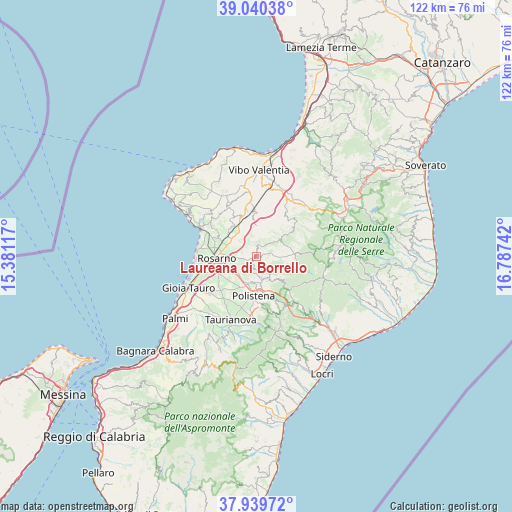
Laureana di Borrello GPS coordinates[2]
38° 29' 31.74" North, 16° 5' 3.444" East
| Map corner | latitude | longitude |
|---|---|---|
| Upper-left | 39.04038°, | 15.38117° |
| Center: | 38.49215°, | 16.08429° |
| Lower-right: | 37.93972°, | 16.78742° |
| Map W x H: | 122.4×122.4 km | = 76.1×76.1mi |
| max Lat: | 47.04031° ⇑94.1% North |
| Laureana di Borrello: | 38.49215° |
| min Lat: | ⇓5.9% South 35.50142° |
| min Long | Laureana di Bor | max Long |
| 6.69888° | 16.08429° | 18.48682° |
| W 93.4%⇐ | ⇒6.6% E |
Elevation
Elevation of Laureana di Borrello is 319 m = 1047 ft, and this is 12.3 m = 40 ft above average elevation for this country.
| Max E: |
2085 m = 6841 ft | 37.5% |
| Laureana di Borrello | 319 m 1047 ft | |
| Avg. | 306.7 m = 1006 ft | |
Min E: |
-4 m = -13 ft | 62.5% |
See also: Italy elevation on elevation.city.
Geographical zone
Laureana di Borrello is located in North temperate zone (between Tropic of Cancer and the Arctic Circle). Distance of this Northern Tropic circle is 1674 km =1040.2 mi to South.| Distance of | km | miles | from Laureana di Borrello |
|---|---|---|---|
| North Pole | 5727.1 | 3558.7 | to North |
| Arctic Circle | 3121.2 | 1939.4 | to North |
| Tropic Cancer | 1674 | 1040.2 | to South |
| Equator | 4279.9 | 2659.4 | to South |


Nearby cities:
15 places around Laureana di Borrello: (largest is in red/bold)
• Anoia Inferiore
6.2 km =3.9 mi,  183°
183°
• Anoia Superiore
6.8 km =4.2 mi,  170°
170°
• Candidoni
1.5 km =0.9 mi,  6°
6°
• Cinque Frondi
8.4 km =5.2 mi, 180°
• Dinami
6.8 km =4.2 mi,  50°
50°
• Feroleto della Chiesa
3.1 km =1.9 mi,  203°
203°
• Galatro
4.1 km =2.5 mi,  149°
149°
• Giffone
8.1 km =5 mi,  136°
136°
• Maropati
5.7 km =3.5 mi, 168°
• Melicucco
7 km =4.3 mi, 199°
• Melicuccà
8.1 km =5 mi, 51°
• Monsoreto
7.6 km =4.7 mi,  70°
70°
• San Pietro di Caridà
5.7 km =3.5 mi, 51°
• Serrata
2.7 km =1.7 mi,  31°
31°
• Tritanti
5.1 km =3.2 mi,  162°
162°
Sources, notices
• [Note1] Compared only with cities in Italy existing in our database
• [Src1] Map data: © OpenStreetMap contributors (CC-BY-SA)
• [Src2] Other city data from geonames.org with taken over terms of usage.
• [Src3] Geographical zone / Annual Mean Temperature by Robert A. Rohde @ Wikipedia
