Marcellinara geodata
Marcellinara (Calabria) is a seat of a third-order administrative division; located in Italy in Europe/Rome (GMT+2) time zone. With population of 1,967 people, there are 4222 cities with bigger population in this country. Compared to other cities in Italy, 92.9% of cities are located further ↑North; 96.4% of cities are located further ←West and 60.9% of cities have lower elevation than Marcellinara. Note1


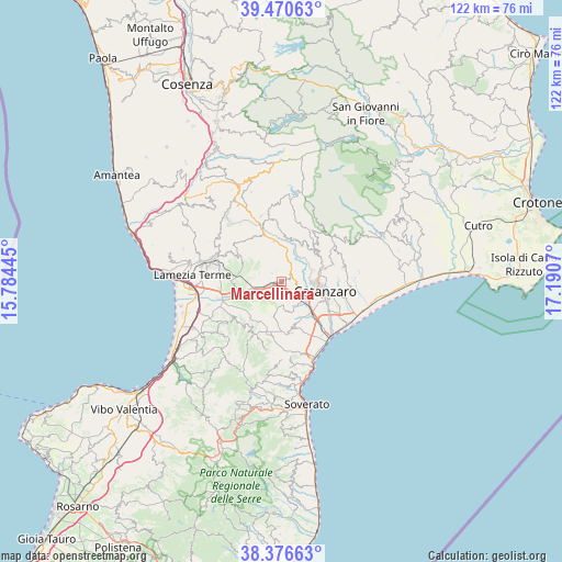
Marcellinara GPS coordinates[2]
38° 55' 32.664" North, 16° 29' 15.252" East
| Map corner | latitude | longitude |
|---|---|---|
| Upper-left | 39.47063°, | 15.78445° |
| Center: | 38.92574°, | 16.48757° |
| Lower-right: | 38.37663°, | 17.1907° |
| Map W x H: | 121.6×121.6 km | = 75.6×75.6mi |
| max Lat: | 47.04031° ⇑92.9% North |
| Marcellinara: | 38.92574° |
| min Lat: | ⇓7.1% South 35.50142° |
| min Long | Marcellinara | max Long |
| 6.69888° | 16.48757° | 18.48682° |
| W 96.4%⇐ | ⇒3.6% E |
Elevation
Elevation of Marcellinara is 306 m = 1004 ft, and this is 0.69999999999999 m = 2 ft below average elevation for this country.
| Max E: |
2085 m = 6841 ft | 39.1% |
| Avg. | 306.7 m = 1006 ft | |
| Marcellinara | 306 m = 1004 ft | |
Min E: |
-4 m = -13 ft | 60.9% |
See also: Italy elevation on elevation.city.
Geographical zone
Marcellinara is located in North temperate zone (between Tropic of Cancer and the Arctic Circle). Distance of this Northern Tropic circle is 1722.2 km =1070.1 mi to South.| Distance of | km | miles | from Marcellinara |
|---|---|---|---|
| North Pole | 5678.9 | 3528.7 | to North |
| Arctic Circle | 3073 | 1909.5 | to North |
| Tropic Cancer | 1722.2 | 1070.1 | to South |
| Equator | 4328.1 | 2689.4 | to South |


Nearby cities:
15 places around Marcellinara: (largest is in red/bold)
• Amato
2.8 km =1.7 mi,  309°
309°
• Cancello
5.3 km =3.3 mi,  288°
288°
• Caraffa di Catanzaro
4.9 km =3 mi,  180°
180°
• Cavora-Lenticchia
6.7 km =4.2 mi,  63°
63°
• Germaneto
8.9 km =5.5 mi,  120°
120°
• Gimigliano
6.5 km =4 mi,  35°
35°
• Martelletto
5.6 km =3.5 mi,  132°
132°
• Miglierina
3.1 km =1.9 mi,  334°
334°
• Pianopoli
9.1 km =5.7 mi, 289°
• Pratora
4.4 km =2.7 mi,  110°
110°
• San Pietro Apostolo
8.9 km =5.5 mi,  348°
348°
• Sant'Elia
9.2 km =5.7 mi,  67°
67°
• Settingiano
2.8 km =1.7 mi, 125°
• Tiriolo
2.6 km =1.6 mi,  49°
49°
• Vena di Maida
8 km =5 mi,  237°
237°
Sources, notices
• [Note1] Compared only with cities in Italy existing in our database
• [Src1] Map data: © OpenStreetMap contributors (CC-BY-SA)
• [Src2] Other city data from geonames.org with taken over terms of usage.
• [Src3] Geographical zone / Annual Mean Temperature by Robert A. Rohde @ Wikipedia
