Cancello geodata
Cancello (Calabria) is a populated place; located in Italy in Europe/Rome (GMT+2) time zone. With population of 556 people, there are 9392 cities with bigger population in this country. Compared to other cities in Italy, 92.9% of cities are located further ↑North; 96% of cities are located further ←West and 57.1% of cities have lower elevation than Cancello. Note1


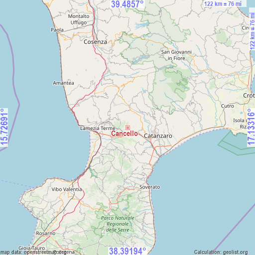
Cancello GPS coordinates[2]
38° 56' 27.348" North, 16° 25' 48.108" East
| Map corner | latitude | longitude |
|---|---|---|
| Upper-left | 39.4857°, | 15.72691° |
| Center: | 38.94093°, | 16.43003° |
| Lower-right: | 38.39194°, | 17.13316° |
| Map W x H: | 121.6×121.6 km | = 75.6×75.6mi |
| max Lat: | 47.04031° ⇑92.9% North |
| Cancello: | 38.94093° |
| min Lat: | ⇓7.1% South 35.50142° |
| min Long | Cancello | max Long |
| 6.69888° | 16.43003° | 18.48682° |
| W 96%⇐ | ⇒4% E |
Elevation
Elevation of Cancello is 279 m = 915 ft, and this is 27.7 m = 91 ft below average elevation for this country.
| Max E: |
2085 m = 6841 ft | 42.9% |
| Avg. | 306.7 m = 1006 ft | |
| Cancello | 279 m = 915 ft | |
Min E: |
-4 m = -13 ft | 57.1% |
See also: Italy elevation on elevation.city.
Geographical zone
Cancello is located in North temperate zone (between Tropic of Cancer and the Arctic Circle). Distance of this Northern Tropic circle is 1723.9 km =1071.2 mi to South.| Distance of | km | miles | from Cancello |
|---|---|---|---|
| North Pole | 5677.2 | 3527.6 | to North |
| Arctic Circle | 3071.3 | 1908.4 | to North |
| Tropic Cancer | 1723.9 | 1071.2 | to South |
| Equator | 4329.8 | 2690.4 | to South |


Nearby cities:
15 places around Cancello: (largest is in red/bold)
• Amato
2.8 km =1.7 mi,  88°
88°
• Caraffa di Catanzaro
8.2 km =5.1 mi,  143°
143°
• Feroleto Antico
4.4 km =2.7 mi,  303°
303°
• Fronti
8.4 km =5.2 mi, 302°
• Gimigliano
9.5 km =5.9 mi,  67°
67°
• Magolà
9.5 km =5.9 mi,  294°
294°
• Marcellinara
5.3 km =3.3 mi,  108°
108°
• Miglierina
3.8 km =2.4 mi, 73°
• Pianopoli
3.8 km =2.4 mi, 289°
• Pratora
9.7 km =6 mi, 109°
• San Pietro Apostolo
7.7 km =4.8 mi,  24°
24°
• Serrastretta
8.1 km =5 mi,  351°
351°
• Settingiano
8 km =5 mi, 114°
• Tiriolo
7 km =4.3 mi, 90°
• Vena di Maida
6.2 km =3.9 mi,  196°
196°
Sources, notices
• [Note1] Compared only with cities in Italy existing in our database
• [Src1] Map data: © OpenStreetMap contributors (CC-BY-SA)
• [Src2] Other city data from geonames.org with taken over terms of usage.
• [Src3] Geographical zone / Annual Mean Temperature by Robert A. Rohde @ Wikipedia
