Pratora geodata
Pratora (Calabria) is a populated place; located in Italy in Europe/Rome (GMT+2) time zone. With population of 645 people, there are 8670 cities with bigger population in this country. Compared to other cities in Italy, 93% of cities are located further ↑North; 96.6% of cities are located further ←West and 59.3% of cities have lower elevation than Pratora. Note1


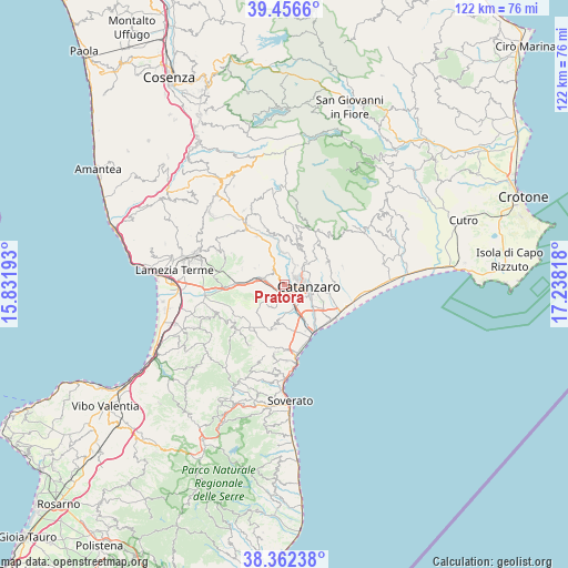
Pratora GPS coordinates[2]
38° 54' 41.76" North, 16° 32' 6.18" East
| Map corner | latitude | longitude |
|---|---|---|
| Upper-left | 39.4566°, | 15.83193° |
| Center: | 38.9116°, | 16.53505° |
| Lower-right: | 38.36238°, | 17.23818° |
| Map W x H: | 121.7×121.7 km | = 75.6×75.6mi |
| max Lat: | 47.04031° ⇑93% North |
| Pratora: | 38.9116° |
| min Lat: | ⇓7% South 35.50142° |
| min Long | Pratora | max Long |
| 6.69888° | 16.53505° | 18.48682° |
| W 96.6%⇐ | ⇒3.4% E |
Elevation
Elevation of Pratora is 294 m = 965 ft, and this is 12.7 m = 42 ft below average elevation for this country.
| Max E: |
2085 m = 6841 ft | 40.7% |
| Avg. | 306.7 m = 1006 ft | |
| Pratora | 294 m = 965 ft | |
Min E: |
-4 m = -13 ft | 59.3% |
See also: Italy elevation on elevation.city.
Geographical zone
Pratora is located in North temperate zone (between Tropic of Cancer and the Arctic Circle). Distance of this Northern Tropic circle is 1720.6 km =1069.1 mi to South.| Distance of | km | miles | from Pratora |
|---|---|---|---|
| North Pole | 5680.5 | 3529.7 | to North |
| Arctic Circle | 3074.6 | 1910.5 | to North |
| Tropic Cancer | 1720.6 | 1069.1 | to South |
| Equator | 4326.6 | 2688.4 | to South |


Nearby cities:
15 places around Pratora: (largest is in red/bold)
• Amato
7.1 km =4.4 mi,  298°
298°
• Caraffa di Catanzaro
5.3 km =3.3 mi,  231°
231°
• Catanzaro
6.6 km =4.1 mi,  119°
119°
• Cava-Cuculera Nobile
7.8 km =4.8 mi,  104°
104°
• Cavora-Lenticchia
4.9 km =3 mi,  22°
22°
• Germaneto
4.7 km =2.9 mi,  129°
129°
• Gimigliano
6.9 km =4.3 mi,  357°
357°
• Marcellinara
4.4 km =2.7 mi,  290°
290°
• Martelletto
2.2 km =1.4 mi,  180°
180°
• Miglierina
6.9 km =4.3 mi,  308°
308°
• San Floro
8.3 km =5.2 mi,  189°
189°
• Sant'Elia
6.7 km =4.2 mi,  40°
40°
• Settingiano
1.8 km =1.1 mi,  269°
269°
• Siano
5.8 km =3.6 mi,  85°
85°
• Tiriolo
3.9 km =2.4 mi,  326°
326°
Sources, notices
• [Note1] Compared only with cities in Italy existing in our database
• [Src1] Map data: © OpenStreetMap contributors (CC-BY-SA)
• [Src2] Other city data from geonames.org with taken over terms of usage.
• [Src3] Geographical zone / Annual Mean Temperature by Robert A. Rohde @ Wikipedia
