Longobucco geodata
Longobucco (Calabria) is a seat of a third-order administrative division; located in Italy in Europe/Rome (GMT+2) time zone. With population of 2,501 people, there are 3520 cities with bigger population in this country. Compared to other cities in Italy, 90.6% of cities are located further ↑North; 97% of cities are located further ←West and 93.2% of cities have lower elevation than Longobucco. Note1


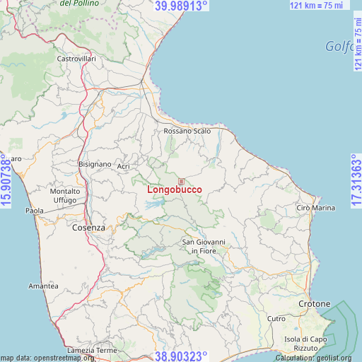
Longobucco GPS coordinates[2]
39° 26' 53.88" North, 16° 36' 37.8" East
| Map corner | latitude | longitude |
|---|---|---|
| Upper-left | 39.98913°, | 15.90738° |
| Center: | 39.4483°, | 16.6105° |
| Lower-right: | 38.90323°, | 17.31363° |
| Map W x H: | 120.7×120.7 km | = 75×75mi |
| max Lat: | 47.04031° ⇑90.6% North |
| Longobucco: | 39.4483° |
| min Lat: | ⇓9.4% South 35.50142° |
| min Long | Longobucco | max Long |
| 6.69888° | 16.6105° | 18.48682° |
| W 97%⇐ | ⇒3% E |
Elevation
Elevation of Longobucco is 808 m = 2651 ft, and this is 501.3 m = 1645 ft above average elevation for this country.
| Max E: |
2085 m = 6841 ft | 6.8% |
| Longobucco | 808 m 2651 ft | |
| Avg. | 306.7 m = 1006 ft | |
Min E: |
-4 m = -13 ft | 93.2% |
See also: Italy elevation on elevation.city.
Geographical zone
Longobucco is located in North temperate zone (between Tropic of Cancer and the Arctic Circle). Distance of this Northern Tropic circle is 1780.3 km =1106.2 mi to South.| Distance of | km | miles | from Longobucco |
|---|---|---|---|
| North Pole | 5620.8 | 3492.6 | to North |
| Arctic Circle | 3014.9 | 1873.4 | to North |
| Tropic Cancer | 1780.3 | 1106.2 | to South |
| Equator | 4386.2 | 2725.5 | to South |


Nearby cities:
15 places around Longobucco: (largest is in red/bold)
• Amica
17.6 km =10.9 mi,  15°
15°
• Bocchigliero
12.5 km =7.8 mi,  105°
105°
• Caloveto
14.4 km =8.9 mi,  63°
63°
• Chimento
17.9 km =11.1 mi,  313°
313°
• Corigliano Calabro
18.2 km =11.3 mi,  334°
334°
• Cropalati
12.5 km =7.8 mi,  52°
52°
• Destro
8.5 km =5.3 mi, 57°
• Foresta
16.2 km =10.1 mi,  322°
322°
• Macchia
17.3 km =10.7 mi,  291°
291°
• Paludi
10.8 km =6.7 mi,  33°
33°
• Pertina
16.4 km =10.2 mi,  297°
297°
• Pietrapaola
18.2 km =11.3 mi,  76°
76°
• Rossano
14.4 km =8.9 mi,  8°
8°
• Rossano Stazione
16.8 km =10.4 mi, 7°
• San Giacomo
15.2 km =9.4 mi, 304°
Sources, notices
• [Note1] Compared only with cities in Italy existing in our database
• [Src1] Map data: © OpenStreetMap contributors (CC-BY-SA)
• [Src2] Other city data from geonames.org with taken over terms of usage.
• [Src3] Geographical zone / Annual Mean Temperature by Robert A. Rohde @ Wikipedia
