Decollatura geodata
Decollatura (Calabria) is a seat of a third-order administrative division; located in Italy in Europe/Rome (GMT+2) time zone. With population of 2,452 people, there are 3583 cities with bigger population in this country. Compared to other cities in Italy, 92.4% of cities are located further ↑North; 95.7% of cities are located further ←West and 92.2% of cities have lower elevation than Decollatura. Note1


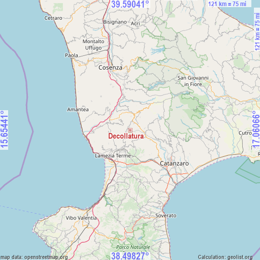
Decollatura GPS coordinates[2]
39° 2' 47.22" North, 16° 21' 27.108" East
| Map corner | latitude | longitude |
|---|---|---|
| Upper-left | 39.59041°, | 15.65441° |
| Center: | 39.04645°, | 16.35753° |
| Lower-right: | 38.49827°, | 17.06066° |
| Map W x H: | 121.4×121.4 km | = 75.4×75.4mi |
| max Lat: | 47.04031° ⇑92.4% North |
| Decollatura: | 39.04645° |
| min Lat: | ⇓7.6% South 35.50142° |
| min Long | Decollatura | max Long |
| 6.69888° | 16.35753° | 18.48682° |
| W 95.7%⇐ | ⇒4.3% E |
Elevation
Elevation of Decollatura is 778 m = 2552 ft, and this is 471.3 m = 1546 ft above average elevation for this country.
| Max E: |
2085 m = 6841 ft | 7.8% |
| Decollatura | 778 m 2552 ft | |
| Avg. | 306.7 m = 1006 ft | |
Min E: |
-4 m = -13 ft | 92.2% |
See also: Italy elevation on elevation.city.
Geographical zone
Decollatura is located in North temperate zone (between Tropic of Cancer and the Arctic Circle). Distance of this Northern Tropic circle is 1735.6 km =1078.5 mi to South.| Distance of | km | miles | from Decollatura |
|---|---|---|---|
| North Pole | 5665.5 | 3520.4 | to North |
| Arctic Circle | 3059.6 | 1901.1 | to North |
| Tropic Cancer | 1735.6 | 1078.5 | to South |
| Equator | 4341.6 | 2697.7 | to South |


Nearby cities:
15 places around Decollatura: (largest is in red/bold)
• Bianchi
7.5 km =4.7 mi,  37°
37°
• Carlopoli
8.4 km =5.2 mi,  84°
84°
• Castagna
6.9 km =4.3 mi, 81°
• Colosimi
8.8 km =5.5 mi,  23°
23°
• Conflenti
6.9 km =4.3 mi,  293°
293°
• Feroleto Antico
9.7 km =6 mi,  164°
164°
• Fronti
7.3 km =4.5 mi,  186°
186°
• Magolà
8.1 km =5 mi,  197°
197°
• Motta Santa Lucia
7.5 km =4.7 mi,  311°
311°
• Nicastro
9.2 km =5.7 mi, 204°
• Panettieri
8.4 km =5.2 mi, 79°
• Pedivigliano
8.4 km =5.2 mi,  327°
327°
• Platania
5.4 km =3.4 mi,  214°
214°
• Serrastretta
6.3 km =3.9 mi,  126°
126°
• Soveria Mannelli
3.9 km =2.4 mi,  25°
25°
Sources, notices
• [Note1] Compared only with cities in Italy existing in our database
• [Src1] Map data: © OpenStreetMap contributors (CC-BY-SA)
• [Src2] Other city data from geonames.org with taken over terms of usage.
• [Src3] Geographical zone / Annual Mean Temperature by Robert A. Rohde @ Wikipedia
