Fronti geodata
Fronti (Calabria) is a populated place; located in Italy in Europe/Rome (GMT+2) time zone. With population of 803 people, there are 7629 cities with bigger population in this country. Compared to other cities in Italy, 92.7% of cities are located further ↑North; 95.6% of cities are located further ←West and 81.4% of cities have lower elevation than Fronti. Note1
Administrative division(s):
- Level 1: Calabria
- Level 2: Provincia di Catanzaro
- Level 3: Lamezia Terme


Fronti GPS coordinates[2]
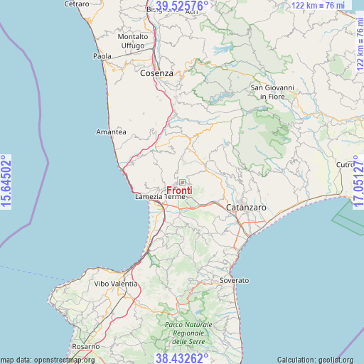
38° 58' 52.68" North, 16° 20' 53.304" East
| Map corner | latitude | longitude |
|---|---|---|
| Upper-left | 39.52576°, | 15.64502° |
| Center: | 38.9813°, | 16.34814° |
| Lower-right: | 38.43262°, | 17.05127° |
| Map W x H: | 121.5×121.5 km | = 75.5×75.5mi |
| max Lat: | 47.04031° ⇑92.7% North |
| Fronti: | 38.9813° |
| min Lat: | ⇓7.3% South 35.50142° |
| min Long | Fronti | max Long |
| 6.69888° | 16.34814° | 18.48682° |
| W 95.6%⇐ | ⇒4.4% E |
Elevation
Elevation of Fronti is 545 m = 1788 ft, and this is 238.3 m = 782 ft above average elevation for this country.
| Max E: |
2085 m = 6841 ft | 18.6% |
| Fronti | 545 m 1788 ft | |
| Avg. | 306.7 m = 1006 ft | |
Min E: |
-4 m = -13 ft | 81.4% |
See also: Italy elevation on elevation.city.
Geographical zone
Fronti is located in North temperate zone (between Tropic of Cancer and the Arctic Circle). Distance of this Northern Tropic circle is 1728.4 km =1074 mi to South.| Distance of | km | miles | from Fronti |
|---|---|---|---|
| North Pole | 5672.7 | 3524.9 | to North |
| Arctic Circle | 3066.9 | 1905.7 | to North |
| Tropic Cancer | 1728.4 | 1074 | to South |
| Equator | 4334.3 | 2693.2 | to South |


Nearby cities:
15 places around Fronti: (largest is in red/bold)
• Amato
10.8 km =6.7 mi,  114°
114°
• Cancello
8.4 km =5.2 mi,  122°
122°
• Castagna
11.2 km =7 mi,  42°
42°
• Decollatura
7.3 km =4.5 mi,  6°
6°
• Feroleto Antico
4 km =2.5 mi, 121°
• Lamezia Terme
3.9 km =2.4 mi,  238°
238°
• Magolà
1.6 km =1 mi,  252°
252°
• Nicastro
3.3 km =2.1 mi, 249°
• Pianopoli
4.7 km =2.9 mi,  132°
132°
• Platania
3.6 km =2.2 mi,  320°
320°
• Sambiase
5.8 km =3.6 mi, 253°
• San Pietro Apostolo
10.7 km =6.6 mi,  76°
76°
• Santa Eufemia Lamezia
10.7 km =6.6 mi,  230°
230°
• Serrastretta
6.9 km =4.3 mi,  58°
58°
• Soveria Mannelli
11 km =6.8 mi, 13°
Sources, notices
• [Note1] Compared only with cities in Italy existing in our database
• [Src1] Map data: © OpenStreetMap contributors (CC-BY-SA)
• [Src2] Other city data from geonames.org with taken over terms of usage.
• [Src3] Geographical zone / Annual Mean Temperature by Robert A. Rohde @ Wikipedia
