Villalta geodata
Villalta (Veneto) is a populated place; located in Italy in Europe/Rome (GMT+2) time zone. With population of 539 people, there are 9552 cities with bigger population in this country. Compared to other cities in Italy, 76.1% of cities are located further ↓South; 51.6% of cities are located further ←West and 84.4% of cities have higher elevation than Villalta. Note1


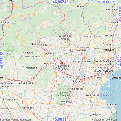
Villalta GPS coordinates[2]
45° 34' 38.676" North, 11° 40' 48.972" East
| Map corner | latitude | longitude |
|---|---|---|
| Upper-left | 46.0674°, | 10.97715° |
| Center: | 45.57741°, | 11.68027° |
| Lower-right: | 45.0831°, | 12.3834° |
| Map W x H: | 109.4×109.4 km | = 68×68mi |
| max Lat: | 47.04031° ⇑23.9% North |
| Villalta: | 45.57741° |
| min Lat: | ⇓76.1% South 35.50142° |
| min Long | Villalta | max Long |
| 6.69888° | 11.68027° | 18.48682° |
| W 51.6%⇐ | ⇒48.4% E |
Elevation
Elevation of Villalta is 33 m = 108 ft, and this is 273.7 m = 898 ft below average elevation for this country.
| Max E: |
2085 m = 6841 ft | 84.4% |
| Avg. | 306.7 m = 1006 ft | |
| Villalta | 33 m = 108 ft | |
Min E: |
-4 m = -13 ft | 15.6% |
See also: Italy elevation on elevation.city.
Geographical zone
Villalta is located in North temperate zone (between Tropic of Cancer and the Arctic Circle). Distance of this North polar circle is 2333.4 km =1449.9 mi to North.| Distance of | km | miles | from Villalta |
|---|---|---|---|
| North Pole | 4939.3 | 3069.1 | to North |
| Arctic Circle | 2333.4 | 1449.9 | to North |
| Tropic Cancer | 2461.8 | 1529.7 | to South |
| Equator | 5067.7 | 3148.9 | to South |


Nearby cities:
15 places around Villalta: (largest is in red/bold)
• Bolzano Vicentino
5.3 km =3.3 mi,  301°
301°
• Camisano Vicentino
6.6 km =4.1 mi,  160°
160°
• Carmignano di Brenta
5.7 km =3.5 mi,  20°
20°
• Gazzo
2.2 km =1.4 mi,  75°
75°
• Grantorto
4.9 km =3 mi,  54°
54°
• Grossa
2.8 km =1.7 mi,  137°
137°
• Lanzè
1.8 km =1.1 mi, 302°
• Lisiera
5.3 km =3.3 mi,  271°
271°
• Marola
5.9 km =3.7 mi,  225°
225°
• Presina
5.9 km =3.7 mi,  108°
108°
• Quinto Vicentino
4.1 km =2.5 mi, 266°
• Rampazzo
4.3 km =2.7 mi,  175°
175°
• San Pietro in Gu
3.5 km =2.2 mi,  351°
351°
• Valproto
3.4 km =2.1 mi, 231°
• Villaggio Montegrappa
6.2 km =3.9 mi,  236°
236°
Sources, notices
• [Note1] Compared only with cities in Italy existing in our database
• [Src1] Map data: © OpenStreetMap contributors (CC-BY-SA)
• [Src2] Other city data from geonames.org with taken over terms of usage.
• [Src3] Geographical zone / Annual Mean Temperature by Robert A. Rohde @ Wikipedia
