Vervò geodata
Vervò (Trentino-Alto Adige) is a seat of a third-order administrative division; located in Italy in Europe/Rome (GMT+2) time zone. With population of 416 people, there are 10213 cities with bigger population in this country. Compared to other cities in Italy, 97% of cities are located further ↓South; 55.6% of cities are located further →East and 95.6% of cities have lower elevation than Vervò. Note1
Administrative division(s):
- Level 1: Trentino-Alto Adige
- Level 2: Provincia autonoma di Trento
- Level 3: Predaia


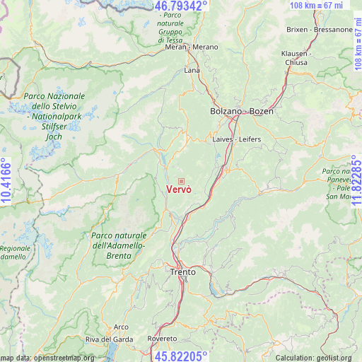
Vervò GPS coordinates[2]
46° 18' 35.604" North, 11° 7' 10.992" East
| Map corner | latitude | longitude |
|---|---|---|
| Upper-left | 46.79342°, | 10.4166° |
| Center: | 46.30989°, | 11.11972° |
| Lower-right: | 45.82205°, | 11.82285° |
| Map W x H: | 108×108 km | = 67.1×67.1mi |
| max Lat: | 47.04031° ⇑3% North |
| Vervò: | 46.30989° |
| min Lat: | ⇓97% South 35.50142° |
| min Long | Vervò | max Long |
| 6.69888° | 11.11972° | 18.48682° |
| W 44.4%⇐ | ⇒55.6% E |
Elevation
Elevation of Vervò is 906 m = 2972 ft, and this is 599.3 m = 1966 ft above average elevation for this country.
| Max E: |
2085 m = 6841 ft | 4.4% |
| Vervò | 906 m 2972 ft | |
| Avg. | 306.7 m = 1006 ft | |
Min E: |
-4 m = -13 ft | 95.6% |
See also: Italy elevation on elevation.city.
Geographical zone
Vervò is located in North temperate zone (between Tropic of Cancer and the Arctic Circle). Distance of this North polar circle is 2252 km =1399.3 mi to North.| Distance of | km | miles | from Vervò |
|---|---|---|---|
| North Pole | 4857.9 | 3018.6 | to North |
| Arctic Circle | 2252 | 1399.3 | to North |
| Tropic Cancer | 2543.3 | 1580.3 | to South |
| Equator | 5149.2 | 3199.6 | to South |


Nearby cities:
15 places around Vervò: (largest is in red/bold)
• Coredo
4.9 km =3 mi,  332°
332°
• Cunevo
7 km =4.3 mi,  248°
248°
• Denno
6.7 km =4.2 mi,  233°
233°
• Flavon
7 km =4.3 mi,  259°
259°
• Magrè sulla Strada del Vino
7.4 km =4.6 mi,  109°
109°
• Nanno
5.6 km =3.5 mi,  275°
275°
• Sanzeno
7.1 km =4.4 mi, 331°
• Segno
3.5 km =2.2 mi, 262°
• Sfruz
3.3 km =2.1 mi,  5°
5°
• Smarano
3.8 km =2.4 mi,  348°
348°
• Taio
4.3 km =2.7 mi,  287°
287°
• Tassullo
6.8 km =4.2 mi,  302°
302°
• Terres
7.4 km =4.6 mi,  270°
270°
• Tres
2.2 km =1.4 mi,  306°
306°
• Vigo di Ton
5.5 km =3.4 mi,  206°
206°
Sources, notices
• [Note1] Compared only with cities in Italy existing in our database
• [Src1] Map data: © OpenStreetMap contributors (CC-BY-SA)
• [Src2] Other city data from geonames.org with taken over terms of usage.
• [Src3] Geographical zone / Annual Mean Temperature by Robert A. Rohde @ Wikipedia
