Vergato geodata
Vergato (Emilia-Romagna) is a seat of a third-order administrative division; located in Italy in Europe/Rome (GMT+2) time zone. With population of 4,697 people, there are 2068 cities with bigger population in this country. Compared to other cities in Italy, 52% of cities are located further ↑North; 55.8% of cities are located further →East and 55.5% of cities have higher elevation than Vergato. Note1


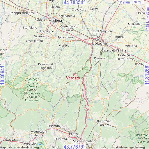
Vergato GPS coordinates[2]
44° 16' 56.352" North, 11° 6' 34.308" East
| Map corner | latitude | longitude |
|---|---|---|
| Upper-left | 44.78354°, | 10.40641° |
| Center: | 44.28232°, | 11.10953° |
| Lower-right: | 43.77679°, | 11.81266° |
| Map W x H: | 111.9×111.9 km | = 69.5×69.5mi |
| max Lat: | 47.04031° ⇑52% North |
| Vergato: | 44.28232° |
| min Lat: | ⇓48% South 35.50142° |
| min Long | Vergato | max Long |
| 6.69888° | 11.10953° | 18.48682° |
| W 44.2%⇐ | ⇒55.8% E |
Elevation
Elevation of Vergato is 199 m = 653 ft, and this is 107.7 m = 353 ft below average elevation for this country.
| Max E: |
2085 m = 6841 ft | 55.5% |
| Avg. | 306.7 m = 1006 ft | |
| Vergato | 199 m = 653 ft | |
Min E: |
-4 m = -13 ft | 44.5% |
See also: Italy elevation on elevation.city.
Geographical zone
Vergato is located in North temperate zone (between Tropic of Cancer and the Arctic Circle). Distance of this Northern Tropic circle is 2317.8 km =1440.2 mi to South.| Distance of | km | miles | from Vergato |
|---|---|---|---|
| North Pole | 5083.3 | 3158.6 | to North |
| Arctic Circle | 2477.4 | 1539.4 | to North |
| Tropic Cancer | 2317.8 | 1440.2 | to South |
| Equator | 4923.7 | 3059.4 | to South |


Nearby cities:
15 places around Vergato: (largest is in red/bold)
• Castel d'Aiano
8.7 km =5.4 mi,  266°
266°
• Grizzana
4.6 km =2.9 mi,  126°
126°
• Grizzana Morandi
4.4 km =2.7 mi, 127°
• Lagaro
9.1 km =5.7 mi,  142°
142°
• Marano
8.5 km =5.3 mi,  223°
223°
• Marzabotto
10.2 km =6.3 mi,  48°
48°
• Montepastore
9.6 km =6 mi,  6°
6°
• Monzuno
12.5 km =7.8 mi,  92°
92°
• Pian di Venola
8.4 km =5.2 mi, 47°
• Pioppe di Salvaro
5.2 km =3.2 mi, 54°
• Riola
7.1 km =4.4 mi, 215°
• Rioveggio
7.2 km =4.5 mi,  97°
97°
• Tolè
6.6 km =4.1 mi,  323°
323°
• Vado
12.5 km =7.8 mi,  72°
72°
• Zocca
11.6 km =7.2 mi,  307°
307°
Sources, notices
• [Note1] Compared only with cities in Italy existing in our database
• [Src1] Map data: © OpenStreetMap contributors (CC-BY-SA)
• [Src2] Other city data from geonames.org with taken over terms of usage.
• [Src3] Geographical zone / Annual Mean Temperature by Robert A. Rohde @ Wikipedia
