Montepastore geodata
Montepastore (Emilia-Romagna) is a populated place; located in Italy in Europe/Rome (GMT+2) time zone. With population of 520 people, there are 9731 cities with bigger population in this country. Compared to other cities in Italy, 50.9% of cities are located further ↑North; 55.6% of cities are located further →East and 84.7% of cities have lower elevation than Montepastore. Note1


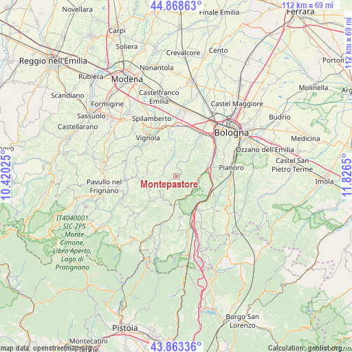
Montepastore GPS coordinates[2]
44° 22' 5.34" North, 11° 7' 24.132" East
| Map corner | latitude | longitude |
|---|---|---|
| Upper-left | 44.86863°, | 10.42025° |
| Center: | 44.36815°, | 11.12337° |
| Lower-right: | 43.86336°, | 11.8265° |
| Map W x H: | 111.8×111.8 km | = 69.5×69.5mi |
| max Lat: | 47.04031° ⇑50.9% North |
| Montepastore: | 44.36815° |
| min Lat: | ⇓49.1% South 35.50142° |
| min Long | Montepastore | max Long |
| 6.69888° | 11.12337° | 18.48682° |
| W 44.4%⇐ | ⇒55.6% E |
Elevation
Elevation of Montepastore is 604 m = 1982 ft, and this is 297.3 m = 975 ft above average elevation for this country.
| Max E: |
2085 m = 6841 ft | 15.3% |
| Montepastore | 604 m 1982 ft | |
| Avg. | 306.7 m = 1006 ft | |
Min E: |
-4 m = -13 ft | 84.7% |
See also: Italy elevation on elevation.city.
Geographical zone
Montepastore is located in North temperate zone (between Tropic of Cancer and the Arctic Circle). Distance of this Northern Tropic circle is 2327.4 km =1446.2 mi to South.| Distance of | km | miles | from Montepastore |
|---|---|---|---|
| North Pole | 5073.8 | 3152.7 | to North |
| Arctic Circle | 2467.9 | 1533.5 | to North |
| Tropic Cancer | 2327.4 | 1446.2 | to South |
| Equator | 4933.3 | 3065.4 | to South |


Nearby cities:
15 places around Montepastore: (largest is in red/bold)
• Calderino
11.6 km =7.2 mi,  31°
31°
• Castelletto
9.3 km =5.8 mi,  329°
329°
• Fontana
9.3 km =5.8 mi,  78°
78°
• Lama di Reno
7.4 km =4.6 mi,  91°
91°
• Marzabotto
7.1 km =4.4 mi,  113°
113°
• Monte San Giovanni
6.9 km =4.3 mi, 33°
• Monteombraro
9.9 km =6.2 mi,  279°
279°
• Pian di Venola
6.4 km =4 mi,  127°
127°
• Pioppe di Salvaro
7.2 km =4.5 mi,  154°
154°
• Sasso Marconi
10.8 km =6.7 mi,  70°
70°
• Savigno
4.7 km =2.9 mi,  304°
304°
• Stiore
11.7 km =7.3 mi,  357°
357°
• Tolè
6.6 km =4.1 mi,  229°
229°
• Vergato
9.6 km =6 mi,  186°
186°
• Zocca
10.7 km =6.6 mi,  256°
256°
Sources, notices
• [Note1] Compared only with cities in Italy existing in our database
• [Src1] Map data: © OpenStreetMap contributors (CC-BY-SA)
• [Src2] Other city data from geonames.org with taken over terms of usage.
• [Src3] Geographical zone / Annual Mean Temperature by Robert A. Rohde @ Wikipedia
