Vandoies di Sopra geodata
Vandoies di Sopra (Trentino-Alto Adige) is a populated place; located in Italy in Europe/Rome (GMT+2) time zone. With population of 544 people, there are 9509 cities with bigger population in this country. Compared to other cities in Italy, 99.7% of cities are located further ↓South; 52.4% of cities are located further ←West and 91.2% of cities have lower elevation than Vandoies di Sopra. Note1


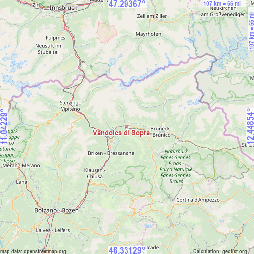
Vandoies di Sopra GPS coordinates[2]
46° 48' 52.668" North, 11° 44' 43.476" East
| Map corner | latitude | longitude |
|---|---|---|
| Upper-left | 47.29367°, | 11.04229° |
| Center: | 46.81463°, | 11.74541° |
| Lower-right: | 46.33129°, | 12.44854° |
| Map W x H: | 107×107 km | = 66.5×66.5mi |
| max Lat: | 47.04031° ⇑0.3% North |
| Vandoies di Sopra: | 46.81463° |
| min Lat: | ⇓99.7% South 35.50142° |
| min Long | Vandoies di Sop | max Long |
| 6.69888° | 11.74541° | 18.48682° |
| W 52.4%⇐ | ⇒47.6% E |
Elevation
Elevation of Vandoies di Sopra is 748 m = 2454 ft, and this is 441.3 m = 1448 ft above average elevation for this country.
| Max E: |
2085 m = 6841 ft | 8.8% |
| Vandoies di Sopra | 748 m 2454 ft | |
| Avg. | 306.7 m = 1006 ft | |
Min E: |
-4 m = -13 ft | 91.2% |
See also: Italy elevation on elevation.city.
Geographical zone
Vandoies di Sopra is located in North temperate zone (between Tropic of Cancer and the Arctic Circle). Distance of this North polar circle is 2195.9 km =1364.5 mi to North.| Distance of | km | miles | from Vandoies di Sopra |
|---|---|---|---|
| North Pole | 4801.8 | 2983.7 | to North |
| Arctic Circle | 2195.9 | 1364.5 | to North |
| Tropic Cancer | 2599.4 | 1615.2 | to South |
| Equator | 5205.3 | 3234.4 | to South |


Nearby cities:
15 places around Vandoies di Sopra: (largest is in red/bold)
• Casteldarne
7.5 km =4.7 mi,  103°
103°
• Chienes
7.3 km =4.5 mi, 96°
• Luson - Luesen
7.7 km =4.8 mi,  171°
171°
• Maranza
6.5 km =4 mi,  270°
270°
• Rio di Pusteria
6.3 km =3.9 mi,  251°
251°
• Rodengo
3.8 km =2.4 mi,  244°
244°
• Rodengo - Rodeneck
5.7 km =3.5 mi,  226°
226°
• San Sigismondo
4.4 km =2.7 mi,  94°
94°
• Sciaves
7.9 km =4.9 mi, 229°
• Terento
3.3 km =2.1 mi,  59°
59°
• Vallarga
3.4 km =2.1 mi,  336°
336°
• Vandoies - Vintl
1.9 km =1.2 mi, 271°
• Vandoies di Sotto
1.8 km =1.1 mi, 274°
• Villa
5.7 km =3.5 mi, 227°
• Villa
7.8 km =4.8 mi, 170°
Sources, notices
• [Note1] Compared only with cities in Italy existing in our database
• [Src1] Map data: © OpenStreetMap contributors (CC-BY-SA)
• [Src2] Other city data from geonames.org with taken over terms of usage.
• [Src3] Geographical zone / Annual Mean Temperature by Robert A. Rohde @ Wikipedia
