Rodengo geodata
Rodengo (Trentino-Alto Adige) is a populated place; located in Italy in Europe/Rome (GMT+2) time zone. With population of 1,170 people, there are 6058 cities with bigger population in this country. Compared to other cities in Italy, 99.7% of cities are located further ↓South; 51.8% of cities are located further ←West and 99.3% of cities have lower elevation than Rodengo. Note1
Administrative division(s):
- Level 1: Trentino-Alto Adige
- Level 2: Bolzano
- Level 3: Rodengo - Rodeneck


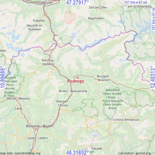
Rodengo GPS coordinates[2]
46° 48' 0" North, 11° 42' 0" East
| Map corner | latitude | longitude |
|---|---|---|
| Upper-left | 47.27917°, | 10.99688° |
| Center: | 46.8°, | 11.7° |
| Lower-right: | 46.31652°, | 12.40313° |
| Map W x H: | 107×107 km | = 66.5×66.5mi |
| max Lat: | 47.04031° ⇑0.3% North |
| Rodengo: | 46.8° |
| min Lat: | ⇓99.7% South 35.50142° |
| min Long | Rodengo | max Long |
| 6.69888° | 11.7° | 18.48682° |
| W 51.8%⇐ | ⇒48.2% E |
Elevation
Elevation of Rodengo is 1351 m = 4432 ft, and this is 1044.3 m = 3426 ft above average elevation for this country.
| Max E: |
2085 m = 6841 ft | 0.7% |
| Rodengo | 1351 m 4432 ft | |
| Avg. | 306.7 m = 1006 ft | |
Min E: |
-4 m = -13 ft | 99.3% |
See also: Italy elevation on elevation.city.
Geographical zone
Rodengo is located in North temperate zone (between Tropic of Cancer and the Arctic Circle). Distance of this North polar circle is 2197.5 km =1365.5 mi to North.| Distance of | km | miles | from Rodengo |
|---|---|---|---|
| North Pole | 4803.4 | 2984.7 | to North |
| Arctic Circle | 2197.5 | 1365.5 | to North |
| Tropic Cancer | 2597.8 | 1614.2 | to South |
| Equator | 5203.7 | 3233.4 | to South |


Nearby cities:
15 places around Rodengo: (largest is in red/bold)
• Fortezza
6.9 km =4.3 mi,  260°
260°
• Luson - Luesen
7.6 km =4.7 mi,  142°
142°
• Maranza
3.5 km =2.2 mi,  298°
298°
• Naz-Sciaves - Natz-Schabs
4.3 km =2.7 mi,  217°
217°
• Novacella
7.5 km =4.7 mi,  212°
212°
• Rio di Pusteria
2.5 km =1.6 mi, 261°
• Rodengo - Rodeneck
2.4 km =1.5 mi,  197°
197°
• Sciaves
4.3 km =2.7 mi, 216°
• Terento
7.1 km =4.4 mi,  62°
62°
• Vallarga
5.2 km =3.2 mi,  23°
23°
• Vandoies - Vintl
2.3 km =1.4 mi,  43°
43°
• Vandoies di Sopra
3.8 km =2.4 mi, 64°
• Vandoies di Sotto
2.4 km =1.5 mi, 43°
• Villa
2.4 km =1.5 mi, 197°
• Villa
7.7 km =4.8 mi, 141°
Sources, notices
• [Note1] Compared only with cities in Italy existing in our database
• [Src1] Map data: © OpenStreetMap contributors (CC-BY-SA)
• [Src2] Other city data from geonames.org with taken over terms of usage.
• [Src3] Geographical zone / Annual Mean Temperature by Robert A. Rohde @ Wikipedia
