Terento geodata
Terento (Trentino-Alto Adige) is a seat of a third-order administrative division; located in Italy in Europe/Rome (GMT+2) time zone. With population of 1,121 people, there are 6206 cities with bigger population in this country. Compared to other cities in Italy, 99.8% of cities are located further ↓South; 52.8% of cities are located further ←West and 98.9% of cities have lower elevation than Terento. Note1
Administrative division(s):
- Level 1: Trentino-Alto Adige
- Level 2: Bolzano
- Level 3: Terento - Terenten


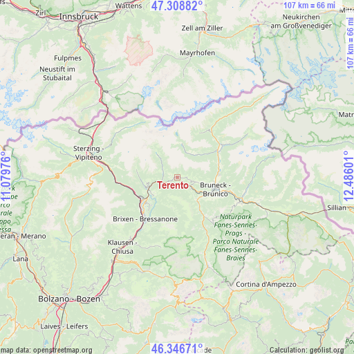
Terento GPS coordinates[2]
46° 49' 47.712" North, 11° 46' 58.368" East
| Map corner | latitude | longitude |
|---|---|---|
| Upper-left | 47.30882°, | 11.07976° |
| Center: | 46.82992°, | 11.78288° |
| Lower-right: | 46.34671°, | 12.48601° |
| Map W x H: | 107×107 km | = 66.5×66.5mi |
| max Lat: | 47.04031° ⇑0.2% North |
| Terento: | 46.82992° |
| min Lat: | ⇓99.8% South 35.50142° |
| min Long | Terento | max Long |
| 6.69888° | 11.78288° | 18.48682° |
| W 52.8%⇐ | ⇒47.2% E |
Elevation
Elevation of Terento is 1242 m = 4075 ft, and this is 935.3 m = 3069 ft above average elevation for this country.
| Max E: |
2085 m = 6841 ft | 1.1% |
| Terento | 1242 m 4075 ft | |
| Avg. | 306.7 m = 1006 ft | |
Min E: |
-4 m = -13 ft | 98.9% |
See also: Italy elevation on elevation.city.
Geographical zone
Terento is located in North temperate zone (between Tropic of Cancer and the Arctic Circle). Distance of this North polar circle is 2194.2 km =1363.4 mi to North.| Distance of | km | miles | from Terento |
|---|---|---|---|
| North Pole | 4800.1 | 2982.6 | to North |
| Arctic Circle | 2194.2 | 1363.4 | to North |
| Tropic Cancer | 2601.1 | 1616.2 | to South |
| Equator | 5207 | 3235.5 | to South |


Nearby cities:
15 places around Terento: (largest is in red/bold)
• Casteldarne
5.6 km =3.5 mi,  128°
128°
• Chienes
5.1 km =3.2 mi,  120°
120°
• Falzes
7.8 km =4.8 mi,  103°
103°
• Fundres
8.8 km =5.5 mi,  318°
318°
• Luson - Luesen
9.5 km =5.9 mi,  190°
190°
• Rodengo
7.1 km =4.4 mi,  242°
242°
• Rodengo - Rodeneck
9 km =5.6 mi,  231°
231°
• San Sigismondo
2.5 km =1.6 mi,  143°
143°
• Selva dei Molini
8.8 km =5.5 mi,  40°
40°
• Vallarga
4.5 km =2.8 mi,  288°
288°
• Vandoies - Vintl
5 km =3.1 mi,  250°
250°
• Vandoies di Sopra
3.3 km =2.1 mi, 239°
• Vandoies di Sotto
4.9 km =3 mi, 251°
• Villa
9 km =5.6 mi, 231°
• Villa
9.5 km =5.9 mi, 189°
Sources, notices
• [Note1] Compared only with cities in Italy existing in our database
• [Src1] Map data: © OpenStreetMap contributors (CC-BY-SA)
• [Src2] Other city data from geonames.org with taken over terms of usage.
• [Src3] Geographical zone / Annual Mean Temperature by Robert A. Rohde @ Wikipedia
