Valenza geodata
Valenza (Piedmont) is a seat of a third-order administrative division; located in Italy in Europe/Rome (GMT+2) time zone. With population of 17,305 people, there are 515 cities with bigger population in this country. Compared to other cities in Italy, 60.2% of cities are located further ↓South; 86.2% of cities are located further →East and 64% of cities have higher elevation than Valenza. Note1


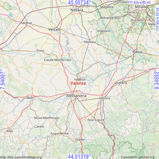
Valenza GPS coordinates[2]
45° 0' 44.712" North, 8° 38' 37.644" East
| Map corner | latitude | longitude |
|---|---|---|
| Upper-left | 45.50734°, | 7.94067° |
| Center: | 45.01242°, | 8.64379° |
| Lower-right: | 44.51319°, | 9.34692° |
| Map W x H: | 110.5×110.5 km | = 68.7×68.7mi |
| max Lat: | 47.04031° ⇑39.8% North |
| Valenza: | 45.01242° |
| min Lat: | ⇓60.2% South 35.50142° |
| min Long | Valenza | max Long |
| 6.69888° | 8.64379° | 18.48682° |
| W 13.8%⇐ | ⇒86.2% E |
Elevation
Elevation of Valenza is 134 m = 440 ft, and this is 172.7 m = 567 ft below average elevation for this country.
| Max E: |
2085 m = 6841 ft | 64% |
| Avg. | 306.7 m = 1006 ft | |
| Valenza | 134 m = 440 ft | |
Min E: |
-4 m = -13 ft | 36% |
See also: Italy elevation on elevation.city.
Geographical zone
Valenza is located in North temperate zone (between Tropic of Cancer and the Arctic Circle). Distance of this North polar circle is 2396.3 km =1489 mi to North.| Distance of | km | miles | from Valenza |
|---|---|---|---|
| North Pole | 5002.1 | 3108.2 | to North |
| Arctic Circle | 2396.3 | 1489 | to North |
| Tropic Cancer | 2399 | 1490.7 | to South |
| Equator | 5004.9 | 3109.9 | to South |


Nearby cities:
15 places around Valenza: (largest is in red/bold)
• Bassignana
7.1 km =4.4 mi,  100°
100°
• Bozzole
7 km =4.3 mi,  334°
334°
• Castelletto Monferrato
7.1 km =4.4 mi,  240°
240°
• Frascarolo
4.9 km =3 mi,  38°
38°
• Giarole
8.1 km =5 mi,  312°
312°
• Montecastello
7.7 km =4.8 mi,  154°
154°
• Pecetto di Valenza
3.3 km =2.1 mi,  141°
141°
• Pietra Marazzi
8 km =5 mi,  165°
165°
• Pomaro Monferrato
6.7 km =4.2 mi, 326°
• Rivarone
6.9 km =4.3 mi,  124°
124°
• San Salvatore Monferrato
6.4 km =4 mi,  252°
252°
• Suardi
8 km =5 mi,  73°
73°
• Torre Beretti
5.7 km =3.5 mi,  21°
21°
• Valle San Bartolomeo
6.9 km =4.3 mi,  182°
182°
• Valmadonna
4.9 km =3 mi,  211°
211°
Sources, notices
• [Note1] Compared only with cities in Italy existing in our database
• [Src1] Map data: © OpenStreetMap contributors (CC-BY-SA)
• [Src2] Other city data from geonames.org with taken over terms of usage.
• [Src3] Geographical zone / Annual Mean Temperature by Robert A. Rohde @ Wikipedia
