Frascarolo geodata
Frascarolo (Lombardy) is a seat of a third-order administrative division; located in Italy in Europe/Rome (GMT+2) time zone. With population of 1,112 people, there are 6251 cities with bigger population in this country. Compared to other cities in Italy, 61.1% of cities are located further ↓South; 85.7% of cities are located further →East and 71.1% of cities have higher elevation than Frascarolo. Note1


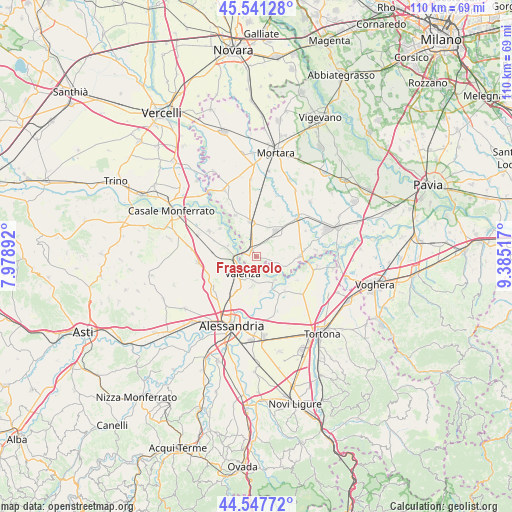
Frascarolo GPS coordinates[2]
45° 2' 47.976" North, 8° 40' 55.344" East
| Map corner | latitude | longitude |
|---|---|---|
| Upper-left | 45.54128°, | 7.97892° |
| Center: | 45.04666°, | 8.68204° |
| Lower-right: | 44.54772°, | 9.38517° |
| Map W x H: | 110.5×110.5 km | = 68.7×68.7mi |
| max Lat: | 47.04031° ⇑38.9% North |
| Frascarolo: | 45.04666° |
| min Lat: | ⇓61.1% South 35.50142° |
| min Long | Frascarolo | max Long |
| 6.69888° | 8.68204° | 18.48682° |
| W 14.3%⇐ | ⇒85.7% E |
Elevation
Elevation of Frascarolo is 92 m = 302 ft, and this is 214.7 m = 704 ft below average elevation for this country.
| Max E: |
2085 m = 6841 ft | 71.1% |
| Avg. | 306.7 m = 1006 ft | |
| Frascarolo | 92 m = 302 ft | |
Min E: |
-4 m = -13 ft | 28.9% |
See also: Italy elevation on elevation.city.
Geographical zone
Frascarolo is located in North temperate zone (between Tropic of Cancer and the Arctic Circle). Distance of this North polar circle is 2392.5 km =1486.6 mi to North.| Distance of | km | miles | from Frascarolo |
|---|---|---|---|
| North Pole | 4998.3 | 3105.8 | to North |
| Arctic Circle | 2392.5 | 1486.6 | to North |
| Tropic Cancer | 2402.8 | 1493 | to South |
| Equator | 5008.7 | 3112.3 | to South |


Nearby cities:
15 places around Frascarolo: (largest is in red/bold)
• Bassignana
6.5 km =4 mi,  141°
141°
• Bozzole
6.5 km =4 mi,  292°
292°
• Gambarana
6.7 km =4.2 mi,  107°
107°
• Giarole
9.2 km =5.7 mi,  280°
280°
• Mede
7 km =4.3 mi,  37°
37°
• Montariolo
9.3 km =5.8 mi,  127°
127°
• Pecetto di Valenza
6.5 km =4 mi,  188°
188°
• Pieve del Cairo
9.5 km =5.9 mi,  88°
88°
• Pomaro Monferrato
7 km =4.3 mi, 284°
• Rivarone
8.2 km =5.1 mi,  161°
161°
• Sartirana Lomellina
7.5 km =4.7 mi,  351°
351°
• Suardi
4.9 km =3 mi, 108°
• Torre Beretti
1.7 km =1.1 mi,  329°
329°
• Valenza
4.9 km =3 mi,  218°
218°
• Villa Biscossi
9.6 km =6 mi,  59°
59°
Sources, notices
• [Note1] Compared only with cities in Italy existing in our database
• [Src1] Map data: © OpenStreetMap contributors (CC-BY-SA)
• [Src2] Other city data from geonames.org with taken over terms of usage.
• [Src3] Geographical zone / Annual Mean Temperature by Robert A. Rohde @ Wikipedia
