Valmadonna geodata
Valmadonna (Piedmont) is a populated place; located in Italy in Europe/Rome (GMT+2) time zone. With population of 1,394 people, there are 5375 cities with bigger population in this country. Compared to other cities in Italy, 59.4% of cities are located further ↓South; 86.6% of cities are located further →East and 65.5% of cities have higher elevation than Valmadonna. Note1
Administrative division(s):
- Level 1: Piedmont
- Level 2: Provincia di Alessandria
- Level 3: Alessandria


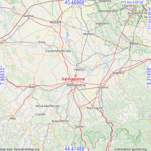
Valmadonna GPS coordinates[2]
44° 58' 27.984" North, 8° 36' 41.256" East
| Map corner | latitude | longitude |
|---|---|---|
| Upper-left | 45.46969°, | 7.90833° |
| Center: | 44.97444°, | 8.61146° |
| Lower-right: | 44.47488°, | 9.31458° |
| Map W x H: | 110.6×110.6 km | = 68.7×68.7mi |
| max Lat: | 47.04031° ⇑40.6% North |
| Valmadonna: | 44.97444° |
| min Lat: | ⇓59.4% South 35.50142° |
| min Long | Valmadonna | max Long |
| 6.69888° | 8.61146° | 18.48682° |
| W 13.4%⇐ | ⇒86.6% E |
Elevation
Elevation of Valmadonna is 125 m = 410 ft, and this is 181.7 m = 596 ft below average elevation for this country.
| Max E: |
2085 m = 6841 ft | 65.5% |
| Avg. | 306.7 m = 1006 ft | |
| Valmadonna | 125 m = 410 ft | |
Min E: |
-4 m = -13 ft | 34.5% |
See also: Italy elevation on elevation.city.
Geographical zone
Valmadonna is located in North temperate zone (between Tropic of Cancer and the Arctic Circle). Distance of this Northern Tropic circle is 2394.8 km =1488.1 mi to South.| Distance of | km | miles | from Valmadonna |
|---|---|---|---|
| North Pole | 5006.4 | 3110.8 | to North |
| Arctic Circle | 2400.5 | 1491.6 | to North |
| Tropic Cancer | 2394.8 | 1488.1 | to South |
| Equator | 5000.7 | 3107.3 | to South |


Nearby cities:
15 places around Valmadonna: (largest is in red/bold)
• Alessandria
7.3 km =4.5 mi,  180°
180°
• Casalbagliano
9.2 km =5.7 mi,  202°
202°
• Castelceriolo
9.1 km =5.7 mi,  134°
134°
• Castelletto Monferrato
3.8 km =2.4 mi,  281°
281°
• Frascarolo
9.8 km =6.1 mi,  34°
34°
• Lobbi
9.8 km =6.1 mi,  120°
120°
• Mirabello Monferrato
9.6 km =6 mi,  314°
314°
• Montecastello
6.5 km =4 mi, 115°
• Pecetto di Valenza
4.9 km =3 mi,  70°
70°
• Pietra Marazzi
5.7 km =3.5 mi, 128°
• Rivarone
8.2 km =5.1 mi,  88°
88°
• San Michele
5.7 km =3.5 mi,  205°
205°
• San Salvatore Monferrato
4.2 km =2.6 mi,  302°
302°
• Valenza
4.9 km =3 mi, 31°
• Valle San Bartolomeo
3.5 km =2.2 mi,  139°
139°
Sources, notices
• [Note1] Compared only with cities in Italy existing in our database
• [Src1] Map data: © OpenStreetMap contributors (CC-BY-SA)
• [Src2] Other city data from geonames.org with taken over terms of usage.
• [Src3] Geographical zone / Annual Mean Temperature by Robert A. Rohde @ Wikipedia
