Turbigo geodata
Turbigo (Lombardy) is a seat of a third-order administrative division; located in Italy in Europe/Rome (GMT+2) time zone. With population of 7,268 people, there are 1338 cities with bigger population in this country. Compared to other cities in Italy, 74.7% of cities are located further ↓South; 85% of cities are located further →East and 62% of cities have higher elevation than Turbigo. Note1
Administrative division(s):
- Level 1: Lombardy
- Level 2: Città metropolitana di Milano
- Level 3: Turbigo


Turbigo GPS coordinates[2]
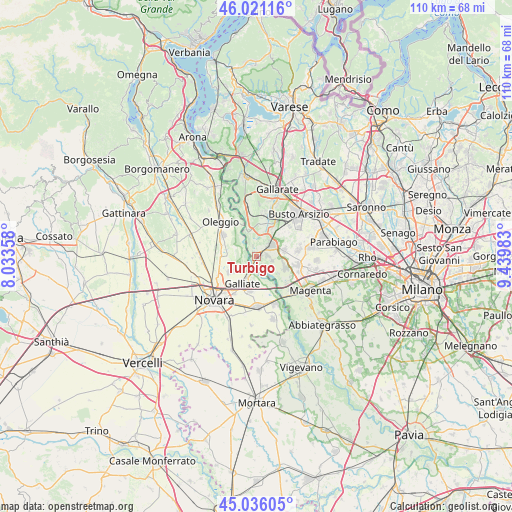
45° 31' 50.736" North, 8° 44' 12.156" East
| Map corner | latitude | longitude |
|---|---|---|
| Upper-left | 46.02116°, | 8.03358° |
| Center: | 45.53076°, | 8.73671° |
| Lower-right: | 45.03605°, | 9.43983° |
| Map W x H: | 109.5×109.5 km | = 68×68mi |
| max Lat: | 47.04031° ⇑25.3% North |
| Turbigo: | 45.53076° |
| min Lat: | ⇓74.7% South 35.50142° |
| min Long | Turbigo | max Long |
| 6.69888° | 8.73671° | 18.48682° |
| W 15%⇐ | ⇒85% E |
Elevation
Elevation of Turbigo is 149 m = 489 ft, and this is 157.7 m = 517 ft below average elevation for this country.
| Max E: |
2085 m = 6841 ft | 62% |
| Avg. | 306.7 m = 1006 ft | |
| Turbigo | 149 m = 489 ft | |
Min E: |
-4 m = -13 ft | 38% |
See also: Italy elevation on elevation.city.
Geographical zone
Turbigo is located in North temperate zone (between Tropic of Cancer and the Arctic Circle). Distance of this North polar circle is 2338.6 km =1453.1 mi to North.| Distance of | km | miles | from Turbigo |
|---|---|---|---|
| North Pole | 4944.5 | 3072.4 | to North |
| Arctic Circle | 2338.6 | 1453.1 | to North |
| Tropic Cancer | 2456.6 | 1526.5 | to South |
| Equator | 5062.5 | 3145.7 | to South |


Nearby cities:
15 places around Turbigo: (largest is in red/bold)
• Bellinzago Novarese
8.4 km =5.2 mi,  300°
300°
• Bernate Ticino
8.6 km =5.3 mi,  132°
132°
• Buscate
6.1 km =3.8 mi,  76°
76°
• Cameri
6.6 km =4.1 mi,  240°
240°
• Casate
8.3 km =5.2 mi,  121°
121°
• Castano Primo
3.8 km =2.4 mi,  52°
52°
• Cuggiono
6.7 km =4.2 mi,  113°
113°
• Galliate
6.5 km =4 mi,  207°
207°
• Lonate Pozzolo
6.9 km =4.3 mi,  9°
9°
• Magnago
7.4 km =4.6 mi,  43°
43°
• Nosate
2.4 km =1.5 mi,  337°
337°
• Robecchetto Con Induno
2.7 km =1.7 mi,  95°
95°
• Romentino
7.7 km =4.8 mi,  190°
190°
• Tornavento
6 km =3.7 mi, 343°
• Vanzaghello
6.5 km =4 mi,  33°
33°
Sources, notices
• [Note1] Compared only with cities in Italy existing in our database
• [Src1] Map data: © OpenStreetMap contributors (CC-BY-SA)
• [Src2] Other city data from geonames.org with taken over terms of usage.
• [Src3] Geographical zone / Annual Mean Temperature by Robert A. Rohde @ Wikipedia
