Trodena geodata
Trodena (Trentino-Alto Adige) is a seat of a third-order administrative division; located in Italy in Europe/Rome (GMT+2) time zone. With population of 658 people, there are 8573 cities with bigger population in this country. Compared to other cities in Italy, 97.1% of cities are located further ↓South; 52.5% of cities are located further →East and 98.2% of cities have lower elevation than Trodena. Note1
Administrative division(s):
- Level 1: Trentino-Alto Adige
- Level 2: Bolzano
- Level 3: Trodena nel parco naturale


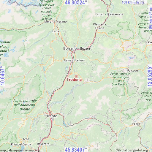
Trodena GPS coordinates[2]
46° 19' 18.516" North, 11° 20' 59.352" East
| Map corner | latitude | longitude |
|---|---|---|
| Upper-left | 46.80524°, | 10.6467° |
| Center: | 46.32181°, | 11.34982° |
| Lower-right: | 45.83407°, | 12.05295° |
| Map W x H: | 108×108 km | = 67.1×67.1mi |
| max Lat: | 47.04031° ⇑2.9% North |
| Trodena: | 46.32181° |
| min Lat: | ⇓97.1% South 35.50142° |
| min Long | Trodena | max Long |
| 6.69888° | 11.34982° | 18.48682° |
| W 47.5%⇐ | ⇒52.5% E |
Elevation
Elevation of Trodena is 1130 m = 3707 ft, and this is 823.3 m = 2701 ft above average elevation for this country.
| Max E: |
2085 m = 6841 ft | 1.8% |
| Trodena | 1130 m 3707 ft | |
| Avg. | 306.7 m = 1006 ft | |
Min E: |
-4 m = -13 ft | 98.2% |
See also: Italy elevation on elevation.city.
Geographical zone
Trodena is located in North temperate zone (between Tropic of Cancer and the Arctic Circle). Distance of this North polar circle is 2250.7 km =1398.5 mi to North.| Distance of | km | miles | from Trodena |
|---|---|---|---|
| North Pole | 4856.6 | 3017.8 | to North |
| Arctic Circle | 2250.7 | 1398.5 | to North |
| Tropic Cancer | 2544.6 | 1581.1 | to South |
| Equator | 5150.5 | 3200.4 | to South |


Nearby cities:
15 places around Trodena: (largest is in red/bold)
• Aldino
4.9 km =3 mi,  4°
4°
• Anterivo
5 km =3.1 mi,  165°
165°
• Bronzolo
9.3 km =5.8 mi,  346°
346°
• Capriana
6.6 km =4.1 mi,  187°
187°
• Carano
7.7 km =4.8 mi,  115°
115°
• Castello Molina di Fiemme
7.8 km =4.8 mi, 124°
• Cavalese
9.1 km =5.7 mi,  112°
112°
• Daiano
7.9 km =4.9 mi, 106°
• Egna
5.9 km =3.7 mi,  265°
265°
• Molina
7.6 km =4.7 mi,  136°
136°
• Montagna
3.9 km =2.4 mi,  283°
283°
• Ora
4.9 km =3 mi,  304°
304°
• Termeno
8.5 km =5.3 mi, 284°
• Valfloriana
8 km =5 mi,  183°
183°
• Varena
8.5 km =5.3 mi,  101°
101°
Sources, notices
• [Note1] Compared only with cities in Italy existing in our database
• [Src1] Map data: © OpenStreetMap contributors (CC-BY-SA)
• [Src2] Other city data from geonames.org with taken over terms of usage.
• [Src3] Geographical zone / Annual Mean Temperature by Robert A. Rohde @ Wikipedia
