Valfloriana geodata
Valfloriana (Trentino-Alto Adige) is a seat of a third-order administrative division; located in Italy in Europe/Rome (GMT+2) time zone. With population of 567 people, there are 9283 cities with bigger population in this country. Compared to other cities in Italy, 96.4% of cities are located further ↓South; 52.6% of cities are located further →East and 94.2% of cities have lower elevation than Valfloriana. Note1
Administrative division(s):
- Level 1: Trentino-Alto Adige
- Level 2: Provincia autonoma di Trento
- Level 3: Valfloriana


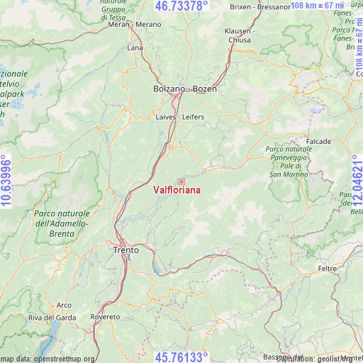
Valfloriana GPS coordinates[2]
46° 14' 58.956" North, 11° 20' 35.088" East
| Map corner | latitude | longitude |
|---|---|---|
| Upper-left | 46.73378°, | 10.63996° |
| Center: | 46.24971°, | 11.34308° |
| Lower-right: | 45.76133°, | 12.04621° |
| Map W x H: | 108.1×108.1 km | = 67.2×67.2mi |
| max Lat: | 47.04031° ⇑3.6% North |
| Valfloriana: | 46.24971° |
| min Lat: | ⇓96.4% South 35.50142° |
| min Long | Valfloriana | max Long |
| 6.69888° | 11.34308° | 18.48682° |
| W 47.4%⇐ | ⇒52.6% E |
Elevation
Elevation of Valfloriana is 845 m = 2772 ft, and this is 538.3 m = 1766 ft above average elevation for this country.
| Max E: |
2085 m = 6841 ft | 5.8% |
| Valfloriana | 845 m 2772 ft | |
| Avg. | 306.7 m = 1006 ft | |
Min E: |
-4 m = -13 ft | 94.2% |
See also: Italy elevation on elevation.city.
Geographical zone
Valfloriana is located in North temperate zone (between Tropic of Cancer and the Arctic Circle). Distance of this North polar circle is 2258.7 km =1403.5 mi to North.| Distance of | km | miles | from Valfloriana |
|---|---|---|---|
| North Pole | 4864.6 | 3022.7 | to North |
| Arctic Circle | 2258.7 | 1403.5 | to North |
| Tropic Cancer | 2536.6 | 1576.2 | to South |
| Equator | 5142.5 | 3195.4 | to South |


Nearby cities:
15 places around Valfloriana: (largest is in red/bold)
• Anterivo
3.6 km =2.2 mi,  29°
29°
• Capriana
1.5 km =0.9 mi,  345°
345°
• Carano
8.8 km =5.5 mi,  57°
57°
• Castello Molina di Fiemme
7.8 km =4.8 mi, 62°
• Cortina sulla Strada del Vino
9.6 km =6 mi,  283°
283°
• Egna
9.3 km =5.8 mi,  324°
324°
• Grauno
4.1 km =2.5 mi,  237°
237°
• Grumes
5 km =3.1 mi,  230°
230°
• Laghetti
8.4 km =5.2 mi,  289°
289°
• Molina
6.2 km =3.9 mi,  66°
66°
• Montagna
9.5 km =5.9 mi,  339°
339°
• Segonzano
9.2 km =5.7 mi,  224°
224°
• Sover
3.8 km =2.4 mi,  214°
214°
• Trodena
8 km =5 mi,  3°
3°
• Valda
7.6 km =4.7 mi, 231°
Sources, notices
• [Note1] Compared only with cities in Italy existing in our database
• [Src1] Map data: © OpenStreetMap contributors (CC-BY-SA)
• [Src2] Other city data from geonames.org with taken over terms of usage.
• [Src3] Geographical zone / Annual Mean Temperature by Robert A. Rohde @ Wikipedia
