Montemerlo geodata
Montemerlo (Veneto) is a populated place; located in Italy in Europe/Rome (GMT+2) time zone. With population of 2,224 people, there are 3838 cities with bigger population in this country. Compared to other cities in Italy, 69.7% of cities are located further ↓South; 51.9% of cities are located further ←West and 92.1% of cities have higher elevation than Montemerlo. Note1
Administrative division(s):
- Level 1: Veneto
- Level 2: Provincia di Padova
- Level 3: Cervarese Santa Croce


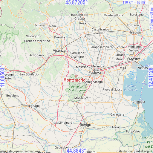
Montemerlo GPS coordinates[2]
45° 22' 49.188" North, 11° 42' 29.34" East
| Map corner | latitude | longitude |
|---|---|---|
| Upper-left | 45.87205°, | 11.00503° |
| Center: | 45.38033°, | 11.70815° |
| Lower-right: | 44.8843°, | 12.41128° |
| Map W x H: | 109.8×109.8 km | = 68.2×68.2mi |
| max Lat: | 47.04031° ⇑30.3% North |
| Montemerlo: | 45.38033° |
| min Lat: | ⇓69.7% South 35.50142° |
| min Long | Montemerlo | max Long |
| 6.69888° | 11.70815° | 18.48682° |
| W 51.9%⇐ | ⇒48.1% E |
Elevation
Elevation of Montemerlo is 14 m = 46 ft, and this is 292.7 m = 960 ft below average elevation for this country.
| Max E: |
2085 m = 6841 ft | 92.1% |
| Avg. | 306.7 m = 1006 ft | |
| Montemerlo | 14 m = 46 ft | |
Min E: |
-4 m = -13 ft | 7.9% |
See also: Italy elevation on elevation.city.
Geographical zone
Montemerlo is located in North temperate zone (between Tropic of Cancer and the Arctic Circle). Distance of this North polar circle is 2355.4 km =1463.6 mi to North.| Distance of | km | miles | from Montemerlo |
|---|---|---|---|
| North Pole | 4961.2 | 3082.7 | to North |
| Arctic Circle | 2355.4 | 1463.6 | to North |
| Tropic Cancer | 2439.9 | 1516.1 | to South |
| Equator | 5045.8 | 3135.3 | to South |


Nearby cities:
15 places around Montemerlo: (largest is in red/bold)
• Abano Terme
6.7 km =4.2 mi,  112°
112°
• Bastia
4.4 km =2.7 mi,  278°
278°
• Canton Madonna
6.6 km =4.1 mi,  43°
43°
• Carbonara
5.8 km =3.6 mi,  253°
253°
• Cervarese Santa Croce
5.1 km =3.2 mi,  342°
342°
• Feriole
3.6 km =2.2 mi,  99°
99°
• Montegaldella
7 km =4.3 mi,  334°
334°
• Saccolongo
3.9 km =2.4 mi,  53°
53°
• San Biagio
2.3 km =1.4 mi, 104°
• San Marco
3.7 km =2.3 mi,  18°
18°
• Selvazzano Dentro
6.6 km =4.1 mi,  82°
82°
• Torreglia
5.4 km =3.4 mi,  156°
156°
• Treponti
1.5 km =0.9 mi,  177°
177°
• Veggiano
7.4 km =4.6 mi,  2°
2°
• Vò
7.8 km =4.8 mi,  221°
221°
Sources, notices
• [Note1] Compared only with cities in Italy existing in our database
• [Src1] Map data: © OpenStreetMap contributors (CC-BY-SA)
• [Src2] Other city data from geonames.org with taken over terms of usage.
• [Src3] Geographical zone / Annual Mean Temperature by Robert A. Rohde @ Wikipedia
