Spinazzola geodata
Spinazzola (Apulia) is a seat of a third-order administrative division; located in Italy in Europe/Rome (GMT+2) time zone. With population of 6,613 people, there are 1481 cities with bigger population in this country. Compared to other cities in Italy, 79% of cities are located further ↑North; 93.5% of cities are located further ←West and 72.7% of cities have lower elevation than Spinazzola. Note1
Administrative division(s):
- Level 1: Apulia
- Level 2: Provincia di Barletta - Andria - Trani
- Level 3: Spinazzola


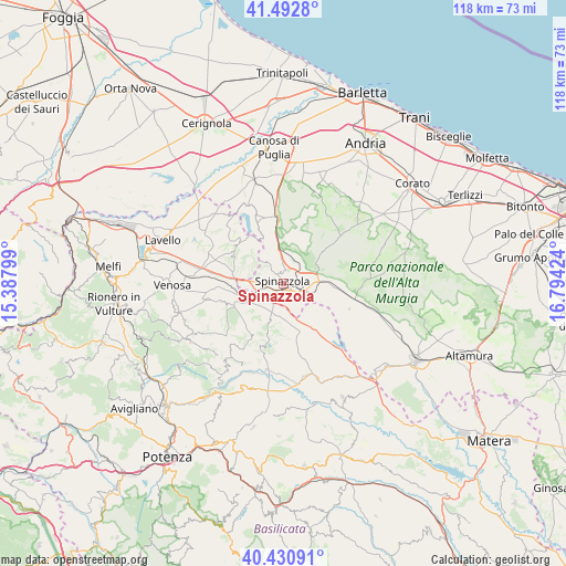
Spinazzola GPS coordinates[2]
40° 57' 50.364" North, 16° 5' 27.996" East
| Map corner | latitude | longitude |
|---|---|---|
| Upper-left | 41.4928°, | 15.38799° |
| Center: | 40.96399°, | 16.09111° |
| Lower-right: | 40.43091°, | 16.79424° |
| Map W x H: | 118.1×118.1 km | = 73.4×73.4mi |
| max Lat: | 47.04031° ⇑79% North |
| Spinazzola: | 40.96399° |
| min Lat: | ⇓21% South 35.50142° |
| min Long | Spinazzola | max Long |
| 6.69888° | 16.09111° | 18.48682° |
| W 93.5%⇐ | ⇒6.5% E |
Elevation
Elevation of Spinazzola is 422 m = 1385 ft, and this is 115.3 m = 378 ft above average elevation for this country.
| Max E: |
2085 m = 6841 ft | 27.3% |
| Spinazzola | 422 m 1385 ft | |
| Avg. | 306.7 m = 1006 ft | |
Min E: |
-4 m = -13 ft | 72.7% |
See also: Italy elevation on elevation.city.
Geographical zone
Spinazzola is located in North temperate zone (between Tropic of Cancer and the Arctic Circle). Distance of this Northern Tropic circle is 1948.8 km =1210.9 mi to South.| Distance of | km | miles | from Spinazzola |
|---|---|---|---|
| North Pole | 5452.3 | 3387.9 | to North |
| Arctic Circle | 2846.4 | 1768.7 | to North |
| Tropic Cancer | 1948.8 | 1210.9 | to South |
| Equator | 4554.8 | 2830.2 | to South |


Nearby cities:
15 places around Spinazzola: (largest is in red/bold)
• Acerenza
22.9 km =14.2 mi,  214°
214°
• Banzi
13.4 km =8.3 mi, 210°
• Cancellara
29.5 km =18.3 mi, 208°
• Canosa di Puglia
28.5 km =17.7 mi,  356°
356°
• Forenza
23 km =14.3 mi,  239°
239°
• Genzano di Lucania
14.1 km =8.8 mi,  200°
200°
• Irsina
26.8 km =16.7 mi,  152°
152°
• Lavello
27 km =16.8 mi,  290°
290°
• Maschito
22.8 km =14.2 mi,  254°
254°
• Minervino Murge
13.2 km =8.2 mi, 355°
• Montemilone
12.6 km =7.8 mi,  304°
304°
• Oppido Lucano
24.1 km =15 mi, 201°
• Palazzo San Gervasio
9.9 km =6.2 mi, 248°
• Poggiorsini
14.9 km =9.3 mi,  111°
111°
• Venosa
23.4 km =14.5 mi,  269°
269°
Sources, notices
• [Note1] Compared only with cities in Italy existing in our database
• [Src1] Map data: © OpenStreetMap contributors (CC-BY-SA)
• [Src2] Other city data from geonames.org with taken over terms of usage.
• [Src3] Geographical zone / Annual Mean Temperature by Robert A. Rohde @ Wikipedia
