Lavello geodata
Lavello (Basilicate) is a seat of a third-order administrative division; located in Italy in Europe/Rome (GMT+2) time zone. With population of 13,086 people, there are 701 cities with bigger population in this country. Compared to other cities in Italy, 78% of cities are located further ↑North; 91.7% of cities are located further ←West and 62.5% of cities have lower elevation than Lavello. Note1


Lavello GPS coordinates[2]
41° 2' 51.684" North, 15° 47' 20.94" East
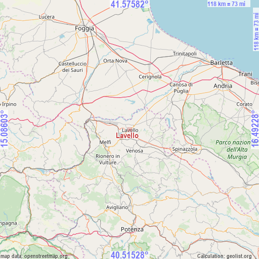
| Map corner | latitude | longitude |
|---|---|---|
| Upper-left | 41.57582°, | 15.08603° |
| Center: | 41.04769°, | 15.78915° |
| Lower-right: | 40.51528°, | 16.49228° |
| Map W x H: | 117.9×117.9 km | = 73.3×73.3mi |
| max Lat: | 47.04031° ⇑78% North |
| Lavello: | 41.04769° |
| min Lat: | ⇓22% South 35.50142° |
| min Long | Lavello | max Long |
| 6.69888° | 15.78915° | 18.48682° |
| W 91.7%⇐ | ⇒8.3% E |
Elevation
Elevation of Lavello is 319 m = 1047 ft, and this is 12.3 m = 40 ft above average elevation for this country.
| Max E: |
2085 m = 6841 ft | 37.5% |
| Lavello | 319 m 1047 ft | |
| Avg. | 306.7 m = 1006 ft | |
Min E: |
-4 m = -13 ft | 62.5% |
See also: Italy elevation on elevation.city.
Geographical zone
Lavello is located in North temperate zone (between Tropic of Cancer and the Arctic Circle). Distance of this Northern Tropic circle is 1958.2 km =1216.8 mi to South.| Distance of | km | miles | from Lavello |
|---|---|---|---|
| North Pole | 5443 | 3382.1 | to North |
| Arctic Circle | 2837.1 | 1762.9 | to North |
| Tropic Cancer | 1958.2 | 1216.8 | to South |
| Equator | 4564.1 | 2836 | to South |


Nearby cities:
15 places around Lavello: (largest is in red/bold)
• Atella
22 km =13.7 mi,  211°
211°
• Barile
15.2 km =9.4 mi,  220°
220°
• Forenza
21.5 km =13.4 mi,  165°
165°
• Ginestra
13.8 km =8.6 mi,  199°
199°
• Maschito
15.8 km =9.8 mi, 167°
• Melfi
12.6 km =7.8 mi,  242°
242°
• Montemilone
15.1 km =9.4 mi,  98°
98°
• Monteverde
22.1 km =13.7 mi,  255°
255°
• Palazzo San Gervasio
20.7 km =12.9 mi,  128°
128°
• Rapolla
12.7 km =7.9 mi,  230°
230°
• Rionero in Vulture
17 km =10.6 mi, 215°
• Ripacandida
15.9 km =9.9 mi, 199°
• Scalera
21.8 km =13.5 mi, 195°
• Venosa
9.6 km =6 mi, 168°
• Zona 179
15.1 km =9.4 mi,  250°
250°
Sources, notices
• [Note1] Compared only with cities in Italy existing in our database
• [Src1] Map data: © OpenStreetMap contributors (CC-BY-SA)
• [Src2] Other city data from geonames.org with taken over terms of usage.
• [Src3] Geographical zone / Annual Mean Temperature by Robert A. Rohde @ Wikipedia
