Senago geodata
Senago (Lombardy) is a seat of a third-order administrative division; located in Italy in Europe/Rome (GMT+2) time zone. With population of 20,620 people, there are 426 cities with bigger population in this country. Compared to other cities in Italy, 76.1% of cities are located further ↓South; 79.2% of cities are located further →East and 59.5% of cities have higher elevation than Senago. Note1
Administrative division(s):
- Level 1: Lombardy
- Level 2: Città metropolitana di Milano
- Level 3: Senago


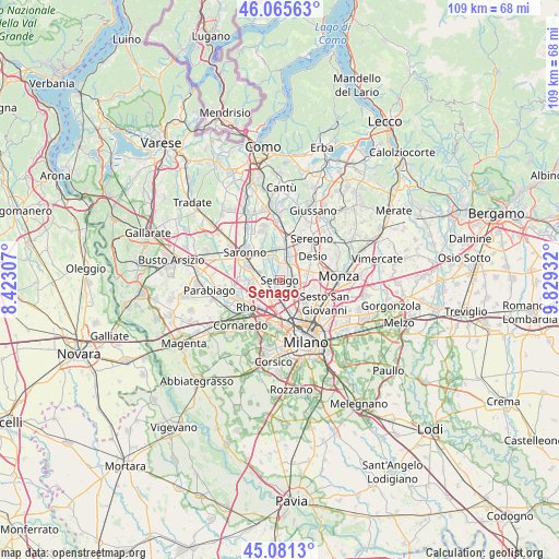
Senago GPS coordinates[2]
45° 34' 32.232" North, 9° 7' 34.32" East
| Map corner | latitude | longitude |
|---|---|---|
| Upper-left | 46.06563°, | 8.42307° |
| Center: | 45.57562°, | 9.1262° |
| Lower-right: | 45.0813°, | 9.82932° |
| Map W x H: | 109.4×109.4 km | = 68×68mi |
| max Lat: | 47.04031° ⇑23.9% North |
| Senago: | 45.57562° |
| min Lat: | ⇓76.1% South 35.50142° |
| min Long | Senago | max Long |
| 6.69888° | 9.1262° | 18.48682° |
| W 20.8%⇐ | ⇒79.2% E |
Elevation
Elevation of Senago is 167 m = 548 ft, and this is 139.7 m = 458 ft below average elevation for this country.
| Max E: |
2085 m = 6841 ft | 59.5% |
| Avg. | 306.7 m = 1006 ft | |
| Senago | 167 m = 548 ft | |
Min E: |
-4 m = -13 ft | 40.5% |
See also: Italy elevation on elevation.city.
Geographical zone
Senago is located in North temperate zone (between Tropic of Cancer and the Arctic Circle). Distance of this North polar circle is 2333.6 km =1450 mi to North.| Distance of | km | miles | from Senago |
|---|---|---|---|
| North Pole | 4939.5 | 3069.3 | to North |
| Arctic Circle | 2333.6 | 1450 | to North |
| Tropic Cancer | 2461.6 | 1529.6 | to South |
| Equator | 5067.5 | 3148.8 | to South |


Nearby cities:
15 places around Senago: (largest is in red/bold)
• Arese
4.7 km =2.9 mi,  233°
233°
• Baranzate
5.4 km =3.4 mi,  187°
187°
• Bollate
3.3 km =2.1 mi, 187°
• Bovisio-Masciago
4.4 km =2.7 mi,  28°
28°
• Cesate
4.5 km =2.8 mi,  299°
299°
• Cormano
3.9 km =2.4 mi,  138°
138°
• Cusano
5.2 km =3.2 mi,  120°
120°
• Garbagnate Milanese
4 km =2.5 mi,  268°
268°
• Limbiate
2.7 km =1.7 mi,  358°
358°
• Nova Milanese
5.8 km =3.6 mi,  75°
75°
• Novate Milanese
5.1 km =3.2 mi,  168°
168°
• Paderno Dugnano
3.1 km =1.9 mi,  103°
103°
• Solaro
5.5 km =3.4 mi,  321°
321°
• Varedo
3.8 km =2.4 mi,  49°
49°
• Villaggio del Sole
4.5 km =2.8 mi,  340°
340°
Sources, notices
• [Note1] Compared only with cities in Italy existing in our database
• [Src1] Map data: © OpenStreetMap contributors (CC-BY-SA)
• [Src2] Other city data from geonames.org with taken over terms of usage.
• [Src3] Geographical zone / Annual Mean Temperature by Robert A. Rohde @ Wikipedia
