Semestene geodata
Semestene (Sardinia) is a seat of a third-order administrative division; located in Italy in Europe/Rome (GMT+2) time zone. With population of 227 people, there are 10998 cities with bigger population in this country. Compared to other cities in Italy, 84.8% of cities are located further ↑North; 85.2% of cities are located further →East and 70.3% of cities have lower elevation than Semestene. Note1


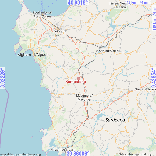
Semestene GPS coordinates[2]
40° 23' 54.456" North, 8° 43' 31.512" East
| Map corner | latitude | longitude |
|---|---|---|
| Upper-left | 40.9318°, | 8.02229° |
| Center: | 40.39846°, | 8.72542° |
| Lower-right: | 39.86086°, | 9.42854° |
| Map W x H: | 119.1×119.1 km | = 74×74mi |
| max Lat: | 47.04031° ⇑84.8% North |
| Semestene: | 40.39846° |
| min Lat: | ⇓15.2% South 35.50142° |
| min Long | Semestene | max Long |
| 6.69888° | 8.72542° | 18.48682° |
| W 14.8%⇐ | ⇒85.2% E |
Elevation
Elevation of Semestene is 397 m = 1302 ft, and this is 90.3 m = 296 ft above average elevation for this country.
| Max E: |
2085 m = 6841 ft | 29.7% |
| Semestene | 397 m 1302 ft | |
| Avg. | 306.7 m = 1006 ft | |
Min E: |
-4 m = -13 ft | 70.3% |
See also: Italy elevation on elevation.city.
Geographical zone
Semestene is located in North temperate zone (between Tropic of Cancer and the Arctic Circle). Distance of this Northern Tropic circle is 1886 km =1171.9 mi to South.| Distance of | km | miles | from Semestene |
|---|---|---|---|
| North Pole | 5515.2 | 3427 | to North |
| Arctic Circle | 2909.3 | 1807.8 | to North |
| Tropic Cancer | 1886 | 1171.9 | to South |
| Equator | 4491.9 | 2791.1 | to South |


Nearby cities:
15 places around Semestene: (largest is in red/bold)
• Bonnanaro
15.3 km =9.5 mi,  12°
12°
• Bonorva
4.3 km =2.7 mi,  58°
58°
• Bortigali
16.1 km =10 mi,  143°
143°
• Borutta
13.9 km =8.6 mi, 6°
• Cheremule
11.8 km =7.3 mi,  0°
0°
• Cossoine
3.7 km =2.3 mi,  347°
347°
• Giave
6.4 km =4 mi,  20°
20°
• Macomer
15.5 km =9.6 mi,  166°
166°
• Mara
7.6 km =4.7 mi,  279°
279°
• Padria
8.1 km =5 mi,  268°
268°
• Pozzomaggiore
5.6 km =3.5 mi, 269°
• Romana
15.2 km =9.4 mi,  308°
308°
• Sindia
12.9 km =8 mi,  206°
206°
• Thiesi
14 km =8.7 mi,  358°
358°
• Torralba
13.2 km =8.2 mi, 14°
Sources, notices
• [Note1] Compared only with cities in Italy existing in our database
• [Src1] Map data: © OpenStreetMap contributors (CC-BY-SA)
• [Src2] Other city data from geonames.org with taken over terms of usage.
• [Src3] Geographical zone / Annual Mean Temperature by Robert A. Rohde @ Wikipedia
