Sindia geodata
Sindia (Sardinia) is a seat of a third-order administrative division; located in Italy in Europe/Rome (GMT+2) time zone. With population of 1,801 people, there are 4490 cities with bigger population in this country. Compared to other cities in Italy, 85.6% of cities are located further ↑North; 86.1% of cities are located further →East and 79% of cities have lower elevation than Sindia. Note1


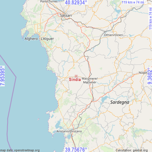
Sindia GPS coordinates[2]
40° 17' 42.648" North, 8° 39' 25.452" East
| Map corner | latitude | longitude |
|---|---|---|
| Upper-left | 40.82934°, | 7.95395° |
| Center: | 40.29518°, | 8.65707° |
| Lower-right: | 39.75676°, | 9.3602° |
| Map W x H: | 119.3×119.3 km | = 74.1×74.1mi |
| max Lat: | 47.04031° ⇑85.6% North |
| Sindia: | 40.29518° |
| min Lat: | ⇓14.4% South 35.50142° |
| min Long | Sindia | max Long |
| 6.69888° | 8.65707° | 18.48682° |
| W 13.9%⇐ | ⇒86.1% E |
Elevation
Elevation of Sindia is 507 m = 1663 ft, and this is 200.3 m = 657 ft above average elevation for this country.
| Max E: |
2085 m = 6841 ft | 21% |
| Sindia | 507 m 1663 ft | |
| Avg. | 306.7 m = 1006 ft | |
Min E: |
-4 m = -13 ft | 79% |
See also: Italy elevation on elevation.city.
Geographical zone
Sindia is located in North temperate zone (between Tropic of Cancer and the Arctic Circle). Distance of this Northern Tropic circle is 1874.5 km =1164.8 mi to South.| Distance of | km | miles | from Sindia |
|---|---|---|---|
| North Pole | 5526.7 | 3434.1 | to North |
| Arctic Circle | 2920.8 | 1814.9 | to North |
| Tropic Cancer | 1874.5 | 1164.8 | to South |
| Equator | 4480.4 | 2784 | to South |


Nearby cities:
15 places around Sindia: (largest is in red/bold)
• Bosa
13.5 km =8.4 mi,  271°
271°
• Flussio
10.6 km =6.6 mi,  251°
251°
• Macomer
10 km =6.2 mi,  111°
111°
• Magomadas
11.9 km =7.4 mi, 252°
• Mara
12.9 km =8 mi,  352°
352°
• Modolo
11 km =6.8 mi,  258°
258°
• Padria
11.5 km =7.1 mi, 348°
• Pozzomaggiore
11.4 km =7.1 mi,  0°
0°
• Sagama
7.7 km =4.8 mi,  241°
241°
• Scano di Montiferro
10.7 km =6.6 mi,  213°
213°
• Semestene
12.9 km =8 mi,  26°
26°
• Sennariolo
12.6 km =7.8 mi,  223°
223°
• Suni
9.3 km =5.8 mi, 260°
• Tinnura
9.7 km =6 mi, 252°
• Tresnuraghes
12.5 km =7.8 mi, 247°
Sources, notices
• [Note1] Compared only with cities in Italy existing in our database
• [Src1] Map data: © OpenStreetMap contributors (CC-BY-SA)
• [Src2] Other city data from geonames.org with taken over terms of usage.
• [Src3] Geographical zone / Annual Mean Temperature by Robert A. Rohde @ Wikipedia
