Seggiano geodata
Seggiano (Tuscany) is a seat of a third-order administrative division; located in Italy in Europe/Rome (GMT+2) time zone. With population of 485 people, there are 9975 cities with bigger population in this country. Compared to other cities in Italy, 63.8% of cities are located further ↑North; 50.2% of cities are located further ←West and 77.5% of cities have lower elevation than Seggiano. Note1


Seggiano GPS coordinates[2]
42° 55' 44.292" North, 11° 33' 26.496" East
| Map corner | latitude | longitude |
|---|---|---|
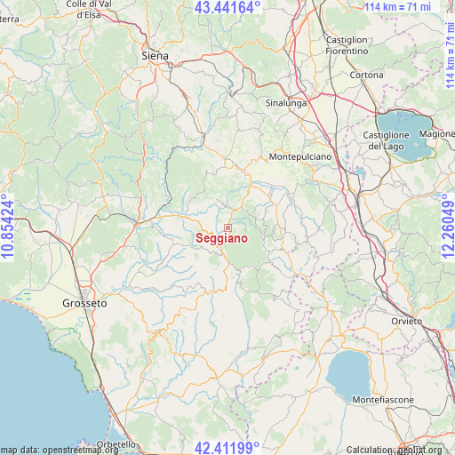
| Upper-left | 43.44164°, | 10.85424° |
| Center: | 42.92897°, | 11.55736° |
| Lower-right: | 42.41199°, | 12.26049° |
| Map W x H: | 114.5×114.5 km | = 71.1×71.1mi |
| max Lat: | 47.04031° ⇑63.8% North |
| Seggiano: | 42.92897° |
| min Lat: | ⇓36.2% South 35.50142° |
| min Long | Seggiano | max Long |
| 6.69888° | 11.55736° | 18.48682° |
| W 50.2%⇐ | ⇒49.8% E |
Elevation
Elevation of Seggiano is 486 m = 1594 ft, and this is 179.3 m = 588 ft above average elevation for this country.
| Max E: |
2085 m = 6841 ft | 22.5% |
| Seggiano | 486 m 1594 ft | |
| Avg. | 306.7 m = 1006 ft | |
Min E: |
-4 m = -13 ft | 77.5% |
See also: Italy elevation on elevation.city.
Geographical zone
Seggiano is located in North temperate zone (between Tropic of Cancer and the Arctic Circle). Distance of this Northern Tropic circle is 2167.3 km =1346.7 mi to South.| Distance of | km | miles | from Seggiano |
|---|---|---|---|
| North Pole | 5233.8 | 3252.1 | to North |
| Arctic Circle | 2627.9 | 1632.9 | to North |
| Tropic Cancer | 2167.3 | 1346.7 | to South |
| Equator | 4773.3 | 2966 | to South |


Nearby cities:
15 places around Seggiano: (largest is in red/bold)
• Abbadia San Salvatore
10.8 km =6.7 mi,  119°
119°
• Arcidosso
6.6 km =4.1 mi,  195°
195°
• Bagnolo
11 km =6.8 mi,  153°
153°
• Castel del Piano
4.3 km =2.7 mi, 200°
• Castiglione d'Orcia
9.6 km =6 mi,  28°
28°
• Cinigiano
14.1 km =8.8 mi,  252°
252°
• Montalcino
15 km =9.3 mi,  338°
338°
• Piancastagnaio
13.9 km =8.6 mi,  128°
128°
• Pienza
19.3 km =12 mi, 30°
• Radicofani
17.6 km =10.9 mi,  101°
101°
• Roccalbegna
16.4 km =10.2 mi,  194°
194°
• San Quirico d'Orcia
14.8 km =9.2 mi,  15°
15°
• Santa Fiora
11.1 km =6.9 mi,  168°
168°
• Torrenieri
17.4 km =10.8 mi,  357°
357°
• Vivo d'Orcia
6.9 km =4.3 mi,  87°
87°
Sources, notices
• [Note1] Compared only with cities in Italy existing in our database
• [Src1] Map data: © OpenStreetMap contributors (CC-BY-SA)
• [Src2] Other city data from geonames.org with taken over terms of usage.
• [Src3] Geographical zone / Annual Mean Temperature by Robert A. Rohde @ Wikipedia
