Roccalbegna geodata
Roccalbegna (Tuscany) is a seat of a third-order administrative division; located in Italy in Europe/Rome (GMT+2) time zone. With population of 260 people, there are 10848 cities with bigger population in this country. Compared to other cities in Italy, 64.7% of cities are located further ↑North; 50.5% of cities are located further →East and 81.3% of cities have lower elevation than Roccalbegna. Note1


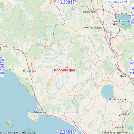
Roccalbegna GPS coordinates[2]
42° 47' 10.68" North, 11° 30' 28.368" East
| Map corner | latitude | longitude |
|---|---|---|
| Upper-left | 43.30017°, | 10.80476° |
| Center: | 42.7863°, | 11.50788° |
| Lower-right: | 42.26813°, | 12.21101° |
| Map W x H: | 114.8×114.8 km | = 71.3×71.3mi |
| max Lat: | 47.04031° ⇑64.7% North |
| Roccalbegna: | 42.7863° |
| min Lat: | ⇓35.3% South 35.50142° |
| min Long | Roccalbegna | max Long |
| 6.69888° | 11.50788° | 18.48682° |
| W 49.5%⇐ | ⇒50.5% E |
Elevation
Elevation of Roccalbegna is 543 m = 1781 ft, and this is 236.3 m = 775 ft above average elevation for this country.
| Max E: |
2085 m = 6841 ft | 18.7% |
| Roccalbegna | 543 m 1781 ft | |
| Avg. | 306.7 m = 1006 ft | |
Min E: |
-4 m = -13 ft | 81.3% |
See also: Italy elevation on elevation.city.
Geographical zone
Roccalbegna is located in North temperate zone (between Tropic of Cancer and the Arctic Circle). Distance of this Northern Tropic circle is 2151.5 km =1336.9 mi to South.| Distance of | km | miles | from Roccalbegna |
|---|---|---|---|
| North Pole | 5249.7 | 3262 | to North |
| Arctic Circle | 2643.8 | 1642.8 | to North |
| Tropic Cancer | 2151.5 | 1336.9 | to South |
| Equator | 4757.4 | 2956.1 | to South |


Nearby cities:
15 places around Roccalbegna: (largest is in red/bold)
• Abbadia San Salvatore
17.1 km =10.6 mi,  51°
51°
• Arcidosso
9.8 km =6.1 mi,  13°
13°
• Bagnolo
10.8 km =6.7 mi,  56°
56°
• Campagnatico
21.9 km =13.6 mi,  299°
299°
• Castel del Piano
12.1 km =7.5 mi, 12°
• Castell'Azzara
15.6 km =9.7 mi,  95°
95°
• Cinigiano
15 km =9.3 mi,  320°
320°
• Piancastagnaio
16.5 km =10.3 mi, 64°
• Pitigliano
21.6 km =13.4 mi,  140°
140°
• Santa Fiora
8 km =5 mi, 51°
• Scansano
18.2 km =11.3 mi,  233°
233°
• Seggiano
16.4 km =10.2 mi, 14°
• Semproniano
6.9 km =4.3 mi,  156°
156°
• Sorano
20.9 km =13 mi,  124°
124°
• Vivo d'Orcia
19.5 km =12.1 mi,  34°
34°
Sources, notices
• [Note1] Compared only with cities in Italy existing in our database
• [Src1] Map data: © OpenStreetMap contributors (CC-BY-SA)
• [Src2] Other city data from geonames.org with taken over terms of usage.
• [Src3] Geographical zone / Annual Mean Temperature by Robert A. Rohde @ Wikipedia
