Radicofani geodata
Radicofani (Tuscany) is a seat of a third-order administrative division; located in Italy in Europe/Rome (GMT+2) time zone. With population of 655 people, there are 8600 cities with bigger population in this country. Compared to other cities in Italy, 63.9% of cities are located further ↑North; 52.7% of cities are located further ←West and 92.1% of cities have lower elevation than Radicofani. Note1


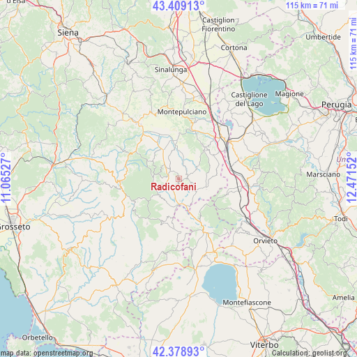
Radicofani GPS coordinates[2]
42° 53' 46.248" North, 11° 46' 6.204" East
| Map corner | latitude | longitude |
|---|---|---|
| Upper-left | 43.40913°, | 11.06527° |
| Center: | 42.89618°, | 11.76839° |
| Lower-right: | 42.37893°, | 12.47152° |
| Map W x H: | 114.5×114.5 km | = 71.1×71.1mi |
| max Lat: | 47.04031° ⇑63.9% North |
| Radicofani: | 42.89618° |
| min Lat: | ⇓36.1% South 35.50142° |
| min Long | Radicofani | max Long |
| 6.69888° | 11.76839° | 18.48682° |
| W 52.7%⇐ | ⇒47.3% E |
Elevation
Elevation of Radicofani is 775 m = 2543 ft, and this is 468.3 m = 1536 ft above average elevation for this country.
| Max E: |
2085 m = 6841 ft | 7.9% |
| Radicofani | 775 m 2543 ft | |
| Avg. | 306.7 m = 1006 ft | |
Min E: |
-4 m = -13 ft | 92.1% |
See also: Italy elevation on elevation.city.
Geographical zone
Radicofani is located in North temperate zone (between Tropic of Cancer and the Arctic Circle). Distance of this Northern Tropic circle is 2163.7 km =1344.5 mi to South.| Distance of | km | miles | from Radicofani |
|---|---|---|---|
| North Pole | 5237.5 | 3254.4 | to North |
| Arctic Circle | 2631.6 | 1635.2 | to North |
| Tropic Cancer | 2163.7 | 1344.5 | to South |
| Equator | 4769.6 | 2963.7 | to South |


Nearby cities:
15 places around Radicofani: (largest is in red/bold)
• Abbadia San Salvatore
8 km =5 mi,  258°
258°
• Bagnolo
13.7 km =8.5 mi,  243°
243°
• Castell'Azzara
14.9 km =9.3 mi,  202°
202°
• Castiglione d'Orcia
17.4 km =10.8 mi,  313°
313°
• Cetona
13.4 km =8.3 mi,  54°
54°
• Chianciano Terme
16.6 km =10.3 mi,  12°
12°
• Piancastagnaio
8.1 km =5 mi,  231°
231°
• Piazze
12.1 km =7.5 mi,  83°
83°
• Ponticelli
17.3 km =10.7 mi, 76°
• Proceno
16.2 km =10.1 mi,  162°
162°
• San Casciano dei Bagni
9.3 km =5.8 mi,  108°
108°
• Santa Fiora
16.6 km =10.3 mi, 244°
• Sarteano
13.2 km =8.2 mi,  36°
36°
• Seggiano
17.6 km =10.9 mi,  281°
281°
• Vivo d'Orcia
11 km =6.8 mi,  290°
290°
Sources, notices
• [Note1] Compared only with cities in Italy existing in our database
• [Src1] Map data: © OpenStreetMap contributors (CC-BY-SA)
• [Src2] Other city data from geonames.org with taken over terms of usage.
• [Src3] Geographical zone / Annual Mean Temperature by Robert A. Rohde @ Wikipedia
