Schio geodata
Schio (Veneto) is a seat of a third-order administrative division; located in Italy in Europe/Rome (GMT+2) time zone. With population of 33,740 people, there are 229 cities with bigger population in this country. Compared to other cities in Italy, 81.8% of cities are located further ↓South; 52.4% of cities are located further →East and 55.5% of cities have higher elevation than Schio. Note1


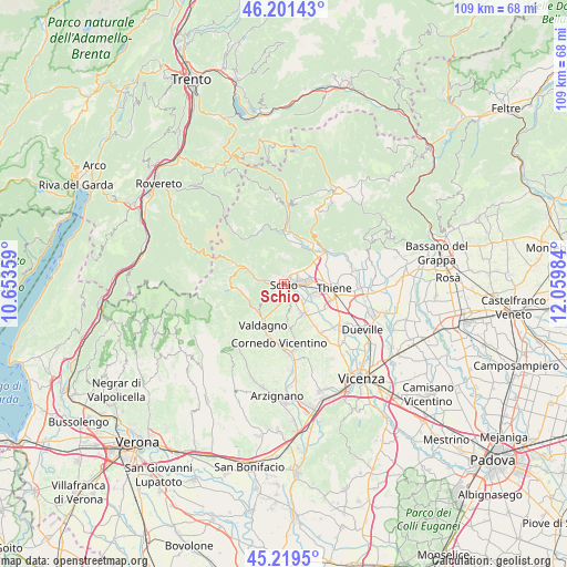
Schio GPS coordinates[2]
45° 42' 45.432" North, 11° 21' 24.156" East
| Map corner | latitude | longitude |
|---|---|---|
| Upper-left | 46.20143°, | 10.65359° |
| Center: | 45.71262°, | 11.35671° |
| Lower-right: | 45.2195°, | 12.05984° |
| Map W x H: | 109.2×109.2 km | = 67.9×67.9mi |
| max Lat: | 47.04031° ⇑18.2% North |
| Schio: | 45.71262° |
| min Lat: | ⇓81.8% South 35.50142° |
| min Long | Schio | max Long |
| 6.69888° | 11.35671° | 18.48682° |
| W 47.6%⇐ | ⇒52.4% E |
Elevation
Elevation of Schio is 199 m = 653 ft, and this is 107.7 m = 353 ft below average elevation for this country.
| Max E: |
2085 m = 6841 ft | 55.5% |
| Avg. | 306.7 m = 1006 ft | |
| Schio | 199 m = 653 ft | |
Min E: |
-4 m = -13 ft | 44.5% |
See also: Italy elevation on elevation.city.
Geographical zone
Schio is located in North temperate zone (between Tropic of Cancer and the Arctic Circle). Distance of this North polar circle is 2318.4 km =1440.6 mi to North.| Distance of | km | miles | from Schio |
|---|---|---|---|
| North Pole | 4924.3 | 3059.8 | to North |
| Arctic Circle | 2318.4 | 1440.6 | to North |
| Tropic Cancer | 2476.8 | 1539 | to South |
| Equator | 5082.8 | 3158.3 | to South |


Nearby cities:
15 places around Schio: (largest is in red/bold)
• Carrè
8.8 km =5.5 mi,  62°
62°
• Giavenale
3.6 km =2.2 mi,  112°
112°
• Malo
7.5 km =4.7 mi,  142°
142°
• Marano Vicentino
6.2 km =3.9 mi, 107°
• Monte di Malo
5.8 km =3.6 mi,  176°
176°
• Piovene Rocchette
7.6 km =4.7 mi,  50°
50°
• San Quirico
7.6 km =4.7 mi,  238°
238°
• San Vito di Leguzzano
4 km =2.5 mi, 141°
• Santorso
3.4 km =2.1 mi, 45°
• Torrebelvicino
3 km =1.9 mi,  276°
276°
• Valli del Pasubio
7.9 km =4.9 mi,  293°
293°
• Velo
8.6 km =5.3 mi,  5°
5°
• Velo d'Astico
8.5 km =5.3 mi, 5°
• Zanè
7.3 km =4.5 mi,  81°
81°
• Zona Industriale
3.8 km =2.4 mi, 81°
Sources, notices
• [Note1] Compared only with cities in Italy existing in our database
• [Src1] Map data: © OpenStreetMap contributors (CC-BY-SA)
• [Src2] Other city data from geonames.org with taken over terms of usage.
• [Src3] Geographical zone / Annual Mean Temperature by Robert A. Rohde @ Wikipedia
