Malo geodata
Malo (Veneto) is a seat of a third-order administrative division; located in Italy in Europe/Rome (GMT+2) time zone. With population of 13,218 people, there are 695 cities with bigger population in this country. Compared to other cities in Italy, 79.4% of cities are located further ↓South; 51.7% of cities are located further →East and 67.4% of cities have higher elevation than Malo. Note1


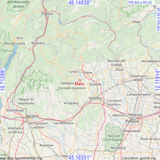
Malo GPS coordinates[2]
45° 39' 32.76" North, 11° 24' 57.636" East
| Map corner | latitude | longitude |
|---|---|---|
| Upper-left | 46.14838°, | 10.71289° |
| Center: | 45.6591°, | 11.41601° |
| Lower-right: | 45.16551°, | 12.11914° |
| Map W x H: | 109.3×109.3 km | = 67.9×67.9mi |
| max Lat: | 47.04031° ⇑20.6% North |
| Malo: | 45.6591° |
| min Lat: | ⇓79.4% South 35.50142° |
| min Long | Malo | max Long |
| 6.69888° | 11.41601° | 18.48682° |
| W 48.3%⇐ | ⇒51.7% E |
Elevation
Elevation of Malo is 113 m = 371 ft, and this is 193.7 m = 635 ft below average elevation for this country.
| Max E: |
2085 m = 6841 ft | 67.4% |
| Avg. | 306.7 m = 1006 ft | |
| Malo | 113 m = 371 ft | |
Min E: |
-4 m = -13 ft | 32.6% |
See also: Italy elevation on elevation.city.
Geographical zone
Malo is located in North temperate zone (between Tropic of Cancer and the Arctic Circle). Distance of this North polar circle is 2324.4 km =1444.3 mi to North.| Distance of | km | miles | from Malo |
|---|---|---|---|
| North Pole | 4930.2 | 3063.5 | to North |
| Arctic Circle | 2324.4 | 1444.3 | to North |
| Tropic Cancer | 2470.9 | 1535.3 | to South |
| Equator | 5076.8 | 3154.6 | to South |


Nearby cities:
15 places around Malo: (largest is in red/bold)
• Castelnovo
5.9 km =3.7 mi,  145°
145°
• Cereda-Cozza Cornedo
7.4 km =4.6 mi,  210°
210°
• Giavenale
4.7 km =2.9 mi,  344°
344°
• Isola Vicentina
4.1 km =2.5 mi,  144°
144°
• Marano Vicentino
4.3 km =2.7 mi,  17°
17°
• Monte di Malo
4.3 km =2.7 mi,  271°
271°
• Novoledo
7.4 km =4.6 mi,  100°
100°
• Rozzampia
7.1 km =4.4 mi,  71°
71°
• San Vito di Leguzzano
3.6 km =2.2 mi,  323°
323°
• Santo
5.8 km =3.6 mi, 73°
• Schio
7.5 km =4.7 mi, 322°
• Thiene
7.4 km =4.6 mi,  41°
41°
• Villaverla
6 km =3.7 mi, 100°
• Zanè
7.5 km =4.7 mi, 20°
• Zona Industriale
6.6 km =4.1 mi,  352°
352°
Sources, notices
• [Note1] Compared only with cities in Italy existing in our database
• [Src1] Map data: © OpenStreetMap contributors (CC-BY-SA)
• [Src2] Other city data from geonames.org with taken over terms of usage.
• [Src3] Geographical zone / Annual Mean Temperature by Robert A. Rohde @ Wikipedia
