Sant'Apollinare geodata
Sant'Apollinare (Latium) is a seat of a third-order administrative division; located in Italy in Europe/Rome (GMT+2) time zone. With population of 984 people, there are 6728 cities with bigger population in this country. Compared to other cities in Italy, 75.5% of cities are located further ↑North; 76.9% of cities are located further ←West and 79% of cities have higher elevation than Sant'Apollinare. Note1
Administrative division(s):
- Level 1: Latium
- Level 2: Provincia di Frosinone
- Level 3: Sant'Apollinare


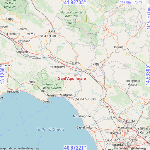
Sant'Apollinare GPS coordinates[2]
41° 24' 6.336" North, 13° 49' 47.712" East
| Map corner | latitude | longitude |
|---|---|---|
| Upper-left | 41.92703°, | 13.1268° |
| Center: | 41.40176°, | 13.82992° |
| Lower-right: | 40.87221°, | 14.53305° |
| Map W x H: | 117.3×117.3 km | = 72.9×72.9mi |
| max Lat: | 47.04031° ⇑75.5% North |
| Sant'Apollinare: | 41.40176° |
| min Lat: | ⇓24.5% South 35.50142° |
| min Long | Sant'Apollinare | max Long |
| 6.69888° | 13.82992° | 18.48682° |
| W 76.9%⇐ | ⇒23.1% E |
Elevation
Elevation of Sant'Apollinare is 54 m = 177 ft, and this is 252.7 m = 829 ft below average elevation for this country.
| Max E: |
2085 m = 6841 ft | 79% |
| Avg. | 306.7 m = 1006 ft | |
| Sant'Apollinare | 54 m = 177 ft | |
Min E: |
-4 m = -13 ft | 21% |
See also: Italy elevation on elevation.city.
Geographical zone
Sant'Apollinare is located in North temperate zone (between Tropic of Cancer and the Arctic Circle). Distance of this Northern Tropic circle is 1997.5 km =1241.2 mi to South.| Distance of | km | miles | from Sant'Apollinare |
|---|---|---|---|
| North Pole | 5403.6 | 3357.6 | to North |
| Arctic Circle | 2797.7 | 1738.4 | to North |
| Tropic Cancer | 1997.5 | 1241.2 | to South |
| Equator | 4603.4 | 2860.4 | to South |


Nearby cities:
15 places around Sant'Apollinare: (largest is in red/bold)
• Ausonia
8.3 km =5.2 mi,  233°
233°
• Bivio Mortola
5.6 km =3.5 mi,  97°
97°
• Cappella Morrone
10.2 km =6.3 mi,  18°
18°
• Casali
6.8 km =4.2 mi,  247°
247°
• Cassino
9.3 km =5.8 mi,  359°
359°
• Castelnuovo Parano
6.6 km =4.1 mi, 247°
• Cervaro
10.8 km =6.7 mi,  33°
33°
• Coreno Ausonio
7.5 km =4.7 mi,  216°
216°
• Pastenelle-Pacitti-Sprumaro
10.4 km =6.5 mi, 25°
• Pignataro Interamna
5.5 km =3.4 mi,  318°
318°
• San Bartolomeo
9.3 km =5.8 mi,  14°
14°
• San Giorgio a Liri
5.9 km =3.7 mi,  274°
274°
• Sant'Ambrogio sul Garigliano
3.4 km =2.1 mi, 104°
• Sant'Andrea del Garigliano
3.8 km =2.4 mi,  164°
164°
• Vallemaio
4.3 km =2.7 mi,  204°
204°
Sources, notices
• [Note1] Compared only with cities in Italy existing in our database
• [Src1] Map data: © OpenStreetMap contributors (CC-BY-SA)
• [Src2] Other city data from geonames.org with taken over terms of usage.
• [Src3] Geographical zone / Annual Mean Temperature by Robert A. Rohde @ Wikipedia
