San Giorgio a Liri geodata
San Giorgio a Liri (Latium) is a seat of a third-order administrative division; located in Italy in Europe/Rome (GMT+2) time zone. With population of 2,069 people, there are 4035 cities with bigger population in this country. Compared to other cities in Italy, 75.5% of cities are located further ↑North; 76.2% of cities are located further ←West and 82.2% of cities have higher elevation than San Giorgio a Liri. Note1
Administrative division(s):
- Level 1: Latium
- Level 2: Provincia di Frosinone
- Level 3: San Giorgio a Liri


San Giorgio a Liri GPS coordinates[2]
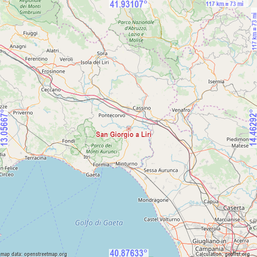
41° 24' 21.024" North, 13° 45' 35.244" East
| Map corner | latitude | longitude |
|---|---|---|
| Upper-left | 41.93107°, | 13.05667° |
| Center: | 41.40584°, | 13.75979° |
| Lower-right: | 40.87633°, | 14.46292° |
| Map W x H: | 117.3×117.3 km | = 72.9×72.9mi |
| max Lat: | 47.04031° ⇑75.5% North |
| San Giorgio a Liri: | 41.40584° |
| min Lat: | ⇓24.5% South 35.50142° |
| min Long | San Giorgio a L | max Long |
| 6.69888° | 13.75979° | 18.48682° |
| W 76.2%⇐ | ⇒23.8% E |
Elevation
Elevation of San Giorgio a Liri is 41 m = 135 ft, and this is 265.7 m = 872 ft below average elevation for this country.
| Max E: |
2085 m = 6841 ft | 82.2% |
| Avg. | 306.7 m = 1006 ft | |
| San Giorgio a Liri | 41 m = 135 ft | |
Min E: |
-4 m = -13 ft | 17.8% |
See also: Italy elevation on elevation.city.
Geographical zone
San Giorgio a Liri is located in North temperate zone (between Tropic of Cancer and the Arctic Circle). Distance of this Northern Tropic circle is 1998 km =1241.5 mi to South.| Distance of | km | miles | from San Giorgio a Liri |
|---|---|---|---|
| North Pole | 5403.2 | 3357.4 | to North |
| Arctic Circle | 2797.3 | 1738.2 | to North |
| Tropic Cancer | 1998 | 1241.5 | to South |
| Equator | 4603.9 | 2860.7 | to South |


Nearby cities:
15 places around San Giorgio a Liri: (largest is in red/bold)
• Ausonia
5.4 km =3.4 mi,  188°
188°
• Casali
3.1 km =1.9 mi, 187°
• Cassino
10.6 km =6.6 mi,  32°
32°
• Castelnuovo Parano
3 km =1.9 mi, 185°
• Coreno Ausonio
6.7 km =4.2 mi,  167°
167°
• Esperia
6.8 km =4.2 mi,  247°
247°
• Monticelli
9.2 km =5.7 mi,  273°
273°
• Piedimonte San Germano
10.3 km =6.4 mi,  355°
355°
• Pignataro Interamna
4.3 km =2.7 mi, 30°
• Pontecorvo
9.8 km =6.1 mi,  306°
306°
• Sant'Ambrogio sul Garigliano
9.2 km =5.7 mi,  98°
98°
• Sant'Andrea del Garigliano
8 km =5 mi,  121°
121°
• Sant'Apollinare
5.9 km =3.7 mi,  94°
94°
• Spigno Saturnia Inferiore
10.7 km =6.6 mi, 190°
• Vallemaio
6 km =3.7 mi,  137°
137°
Sources, notices
• [Note1] Compared only with cities in Italy existing in our database
• [Src1] Map data: © OpenStreetMap contributors (CC-BY-SA)
• [Src2] Other city data from geonames.org with taken over terms of usage.
• [Src3] Geographical zone / Annual Mean Temperature by Robert A. Rohde @ Wikipedia
