San Pietro Avellana geodata
San Pietro Avellana (Molise) is a seat of a third-order administrative division; located in Italy in Europe/Rome (GMT+2) time zone. With population of 488 people, there are 9968 cities with bigger population in this country. Compared to other cities in Italy, 72% of cities are located further ↑North; 79.6% of cities are located further ←West and 96.6% of cities have lower elevation than San Pietro Avellana. Note1
Administrative division(s):
- Level 1: Molise
- Level 2: Provincia di Isernia
- Level 3: San Pietro Avellana


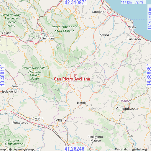
San Pietro Avellana GPS coordinates[2]
41° 47' 19.896" North, 14° 10' 59.628" East
| Map corner | latitude | longitude |
|---|---|---|
| Upper-left | 42.31097°, | 13.48011° |
| Center: | 41.78886°, | 14.18323° |
| Lower-right: | 41.26246°, | 14.88636° |
| Map W x H: | 116.6×116.6 km | = 72.5×72.5mi |
| max Lat: | 47.04031° ⇑72% North |
| San Pietro Avellana: | 41.78886° |
| min Lat: | ⇓28% South 35.50142° |
| min Long | San Pietro Avel | max Long |
| 6.69888° | 14.18323° | 18.48682° |
| W 79.6%⇐ | ⇒20.4% E |
Elevation
Elevation of San Pietro Avellana is 968 m = 3176 ft, and this is 661.3 m = 2170 ft above average elevation for this country.
| Max E: |
2085 m = 6841 ft | 3.4% |
| San Pietro Avellana | 968 m 3176 ft | |
| Avg. | 306.7 m = 1006 ft | |
Min E: |
-4 m = -13 ft | 96.6% |
See also: Italy elevation on elevation.city.
Geographical zone
San Pietro Avellana is located in North temperate zone (between Tropic of Cancer and the Arctic Circle). Distance of this Northern Tropic circle is 2040.6 km =1268 mi to South.| Distance of | km | miles | from San Pietro Avellana |
|---|---|---|---|
| North Pole | 5360.6 | 3330.9 | to North |
| Arctic Circle | 2754.7 | 1711.7 | to North |
| Tropic Cancer | 2040.6 | 1268 | to South |
| Equator | 4646.5 | 2887.2 | to South |


Nearby cities:
15 places around San Pietro Avellana: (largest is in red/bold)
• Ateleta
7.4 km =4.6 mi,  9°
9°
• Capracotta
8.4 km =5.2 mi,  54°
54°
• Carovilli
12.4 km =7.7 mi,  132°
132°
• Castel del Giudice
8.4 km =5.2 mi,  28°
28°
• Castel di Sangro
6.4 km =4 mi,  265°
265°
• Forlì del Sannio
10.3 km =6.4 mi,  181°
181°
• Gamberale
13.1 km =8.1 mi, 9°
• Montenero Val Cocchiara
12.4 km =7.7 mi,  229°
229°
• Rionero Sannitico
9.3 km =5.8 mi,  203°
203°
• Rivisondoli
13.2 km =8.2 mi,  313°
313°
• Roccaraso
10.9 km =6.8 mi, 307°
• Roccasicura
11 km =6.8 mi,  158°
158°
• Sant'Angelo del Pesco
11.9 km =7.4 mi, 29°
• Scontrone
12.9 km =8 mi,  248°
248°
• Vastogirardi
6.4 km =4 mi,  104°
104°
Sources, notices
• [Note1] Compared only with cities in Italy existing in our database
• [Src1] Map data: © OpenStreetMap contributors (CC-BY-SA)
• [Src2] Other city data from geonames.org with taken over terms of usage.
• [Src3] Geographical zone / Annual Mean Temperature by Robert A. Rohde @ Wikipedia
