Ronzone geodata
Ronzone (Trentino-Alto Adige) is a seat of a third-order administrative division; located in Italy in Europe/Rome (GMT+2) time zone. With population of 385 people, there are 10343 cities with bigger population in this country. Compared to other cities in Italy, 97.9% of cities are located further ↓South; 55.1% of cities are located further →East and 98% of cities have lower elevation than Ronzone. Note1
Administrative division(s):
- Level 1: Trentino-Alto Adige
- Level 2: Provincia autonoma di Trento
- Level 3: Ronzone


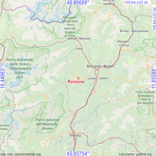
Ronzone GPS coordinates[2]
46° 25' 27.732" North, 11° 9' 9.9" East
| Map corner | latitude | longitude |
|---|---|---|
| Upper-left | 46.90689°, | 10.44963° |
| Center: | 46.42437°, | 11.15275° |
| Lower-right: | 45.93754°, | 11.85588° |
| Map W x H: | 107.8×107.8 km | = 67×67mi |
| max Lat: | 47.04031° ⇑2.1% North |
| Ronzone: | 46.42437° |
| min Lat: | ⇓97.9% South 35.50142° |
| min Long | Ronzone | max Long |
| 6.69888° | 11.15275° | 18.48682° |
| W 44.9%⇐ | ⇒55.1% E |
Elevation
Elevation of Ronzone is 1098 m = 3602 ft, and this is 791.3 m = 2596 ft above average elevation for this country.
| Max E: |
2085 m = 6841 ft | 2% |
| Ronzone | 1098 m 3602 ft | |
| Avg. | 306.7 m = 1006 ft | |
Min E: |
-4 m = -13 ft | 98% |
See also: Italy elevation on elevation.city.
Geographical zone
Ronzone is located in North temperate zone (between Tropic of Cancer and the Arctic Circle). Distance of this North polar circle is 2239.3 km =1391.4 mi to North.| Distance of | km | miles | from Ronzone |
|---|---|---|---|
| North Pole | 4845.2 | 3010.7 | to North |
| Arctic Circle | 2239.3 | 1391.4 | to North |
| Tropic Cancer | 2556 | 1588.2 | to South |
| Equator | 5161.9 | 3207.5 | to South |


Nearby cities:
15 places around Ronzone: (largest is in red/bold)
• Amblar
3.3 km =2.1 mi,  188°
188°
• Brez
3.7 km =2.3 mi,  283°
283°
• Caldaro sulla Strada del Vino
7.3 km =4.5 mi,  99°
99°
• Castelfondo
4.4 km =2.7 mi,  322°
322°
• Cavareno
2.1 km =1.3 mi,  209°
209°
• Cloz
5.2 km =3.2 mi,  259°
259°
• Dambel
5.1 km =3.2 mi,  244°
244°
• Don
4.1 km =2.5 mi,  197°
197°
• Fondo
2 km =1.2 mi, 323°
• Lauregno
7.7 km =4.8 mi,  295°
295°
• Malosco
1.4 km =0.9 mi,  339°
339°
• Romallo
7.3 km =4.5 mi,  245°
245°
• Romeno
4.2 km =2.6 mi,  217°
217°
• Ruffrè
2.2 km =1.4 mi,  118°
118°
• Sarnonico
1 km =0.6 mi, 236°
Sources, notices
• [Note1] Compared only with cities in Italy existing in our database
• [Src1] Map data: © OpenStreetMap contributors (CC-BY-SA)
• [Src2] Other city data from geonames.org with taken over terms of usage.
• [Src3] Geographical zone / Annual Mean Temperature by Robert A. Rohde @ Wikipedia
