Rocchetta Nervina geodata
Rocchetta Nervina (Liguria) is a seat of a third-order administrative division; located in Italy in Europe/Rome (GMT+2) time zone. With population of 268 people, there are 10809 cities with bigger population in this country. Compared to other cities in Italy, 55.8% of cities are located further ↑North; 97.1% of cities are located further →East and 52.5% of cities have higher elevation than Rocchetta Nervina. Note1
Administrative division(s):
- Level 1: Liguria
- Level 2: Provincia di Imperia
- Level 3: Rocchetta Nervina


Rocchetta Nervina GPS coordinates[2]
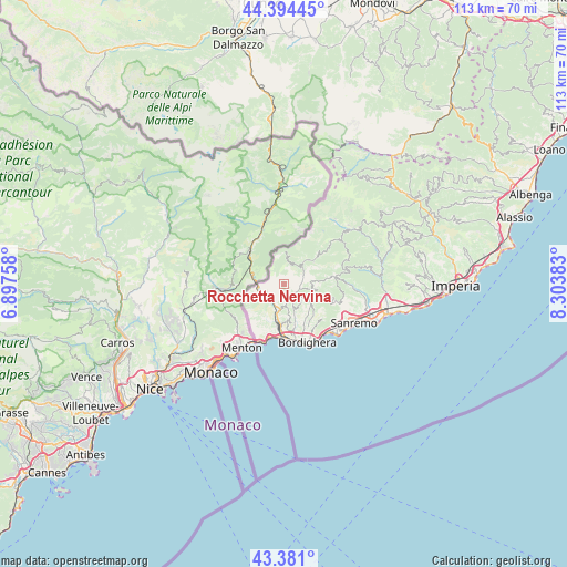
43° 53' 23.568" North, 7° 36' 2.556" East
| Map corner | latitude | longitude |
|---|---|---|
| Upper-left | 44.39445°, | 6.89758° |
| Center: | 43.88988°, | 7.60071° |
| Lower-right: | 43.381°, | 8.30383° |
| Map W x H: | 112.7×112.7 km | = 70×70mi |
| max Lat: | 47.04031° ⇑55.8% North |
| Rocchetta Nervina: | 43.88988° |
| min Lat: | ⇓44.2% South 35.50142° |
| min Long | Rocchetta Nervi | max Long |
| 6.69888° | 7.60071° | 18.48682° |
| W 2.9%⇐ | ⇒97.1% E |
Elevation
Elevation of Rocchetta Nervina is 219 m = 719 ft, and this is 87.7 m = 288 ft below average elevation for this country.
| Max E: |
2085 m = 6841 ft | 52.5% |
| Avg. | 306.7 m = 1006 ft | |
| Rocchetta Nervina | 219 m = 719 ft | |
Min E: |
-4 m = -13 ft | 47.5% |
See also: Italy elevation on elevation.city.
Geographical zone
Rocchetta Nervina is located in North temperate zone (between Tropic of Cancer and the Arctic Circle). Distance of this Northern Tropic circle is 2274.2 km =1413.1 mi to South.| Distance of | km | miles | from Rocchetta Nervina |
|---|---|---|---|
| North Pole | 5127 | 3185.8 | to North |
| Arctic Circle | 2521.1 | 1566.5 | to North |
| Tropic Cancer | 2274.2 | 1413.1 | to South |
| Equator | 4880.1 | 3032.4 | to South |


Nearby cities:
15 places around Rocchetta Nervina: (largest is in red/bold)
• Airole
4.3 km =2.7 mi,  240°
240°
• Apricale
4.9 km =3 mi,  102°
102°
• Bajardo
10.1 km =6.3 mi,  81°
81°
• Camporosso
8.8 km =5.5 mi,  165°
165°
• Castel Vittorio
7.3 km =4.5 mi,  54°
54°
• Dolceacqua
4.8 km =3 mi,  157°
157°
• Isolabona
3.3 km =2.1 mi,  107°
107°
• Latte
11 km =6.8 mi,  194°
194°
• Olivetta San Michele
7 km =4.3 mi,  259°
259°
• Perinaldo
6.3 km =3.9 mi, 114°
• Pigna
6.7 km =4.2 mi, 45°
• San Biagio della Cima
9 km =5.6 mi,  153°
153°
• Seborga
10.3 km =6.4 mi,  132°
132°
• Soldano
8.1 km =5 mi, 146°
• Vallebona
10.1 km =6.3 mi, 149°
Sources, notices
• [Note1] Compared only with cities in Italy existing in our database
• [Src1] Map data: © OpenStreetMap contributors (CC-BY-SA)
• [Src2] Other city data from geonames.org with taken over terms of usage.
• [Src3] Geographical zone / Annual Mean Temperature by Robert A. Rohde @ Wikipedia
