Olivetta San Michele geodata
Olivetta San Michele (Liguria) is a seat of a third-order administrative division; located in Italy in Europe/Rome (GMT+2) time zone. With population of 238 people, there are 10944 cities with bigger population in this country. Compared to other cities in Italy, 56% of cities are located further ↑North; 97.7% of cities are located further →East and 53.4% of cities have lower elevation than Olivetta San Michele. Note1
Administrative division(s):
- Level 1: Liguria
- Level 2: Provincia di Imperia
- Level 3: Olivetta San Michele
Current local time in Olivetta San Michele:
09:02 PM, WednesdayDifference from your time zone: hours


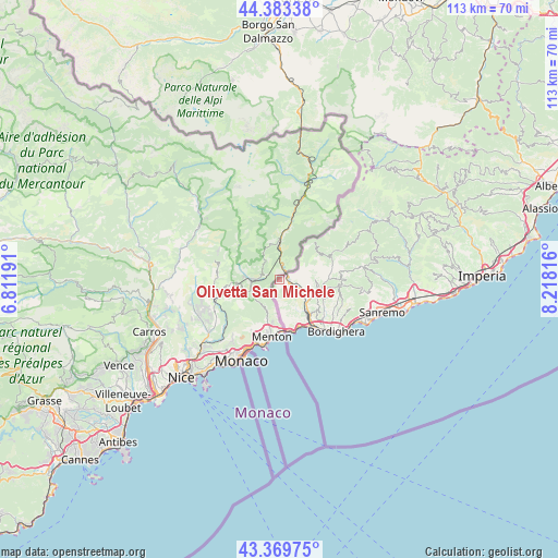
Olivetta San Michele GPS coordinates[2]
43° 52' 43.392" North, 7° 30' 54.144" East
| Map corner | latitude | longitude |
|---|---|---|
| Upper-left | 44.38338°, | 6.81191° |
| Center: | 43.87872°, | 7.51504° |
| Lower-right: | 43.36975°, | 8.21816° |
| Map W x H: | 112.7×112.7 km | = 70×70mi |
| max Lat: | 47.04031° ⇑56% North |
| Olivetta San Michele: | 43.87872° |
| min Lat: | ⇓44% South 35.50142° |
| min Long | Olivetta San Mi | max Long |
| 6.69888° | 7.51504° | 18.48682° |
| W 2.3%⇐ | ⇒97.7% E |
Elevation
Elevation of Olivetta San Michele is 255 m = 837 ft, and this is 51.7 m = 170 ft below average elevation for this country.
| Max E: |
2085 m = 6841 ft | 46.6% |
| Avg. | 306.7 m = 1006 ft | |
| Olivetta San Michele | 255 m = 837 ft | |
Min E: |
-4 m = -13 ft | 53.4% |
See also: Italy elevation on elevation.city.
Geographical zone
Olivetta San Michele is located in North temperate zone (between Tropic of Cancer and the Arctic Circle). Distance of this Northern Tropic circle is 2272.9 km =1412.3 mi to South.| Distance of | km | miles | from Olivetta San Michele |
|---|---|---|---|
| North Pole | 5128.2 | 3186.5 | to North |
| Arctic Circle | 2522.3 | 1567.3 | to North |
| Tropic Cancer | 2272.9 | 1412.3 | to South |
| Equator | 4878.9 | 3031.6 | to South |


Nearby cities:
15 places around Olivetta San Michele: (largest is in red/bold)
• Airole
3.3 km =2.1 mi,  105°
105°
• Apricale
11.6 km =7.2 mi,  89°
89°
• Camporosso
11.6 km =7.2 mi,  128°
128°
• Castel Vittorio
13.9 km =8.6 mi,  67°
67°
• Dolceacqua
9.3 km =5.8 mi, 110°
• Isolabona
10 km =6.2 mi, 88°
• Latte
10.3 km =6.4 mi,  156°
156°
• Perinaldo
12.6 km =7.8 mi,  95°
95°
• Pigna
13.1 km =8.1 mi,  63°
63°
• Rocchetta Nervina
7 km =4.3 mi,  79°
79°
• San Biagio della Cima
12.9 km =8 mi,  121°
121°
• Soldano
12.6 km =7.8 mi, 115°
• Vallebona
14.1 km =8.8 mi, 121°
• Vallecrosia
14.3 km =8.9 mi,  135°
135°
• Ventimiglia
12.4 km =7.7 mi, 142°
Sources, notices
• [Note1] Compared only with cities in Italy existing in our database
• [Src1] Map data: © OpenStreetMap contributors (CC-BY-SA)
• [Src2] Other city data from geonames.org with taken over terms of usage.
• [Src3] Geographical zone / Annual Mean Temperature by Robert A. Rohde @ Wikipedia
