Roccavivi geodata
Roccavivi (Abruzzo) is a populated place; located in Italy in Europe/Rome (GMT+2) time zone. With population of 1,046 people, there are 6479 cities with bigger population in this country. Compared to other cities in Italy, 71.9% of cities are located further ↑North; 74% of cities are located further ←West and 76.6% of cities have lower elevation than Roccavivi. Note1
Administrative division(s):
- Level 1: Abruzzo
- Level 2: Provincia dell' Aquila
- Level 3: San Vincenzo Valle Roveto


Roccavivi GPS coordinates[2]
41° 48' 43.704" North, 13° 32' 11.832" East
| Map corner | latitude | longitude |
|---|---|---|
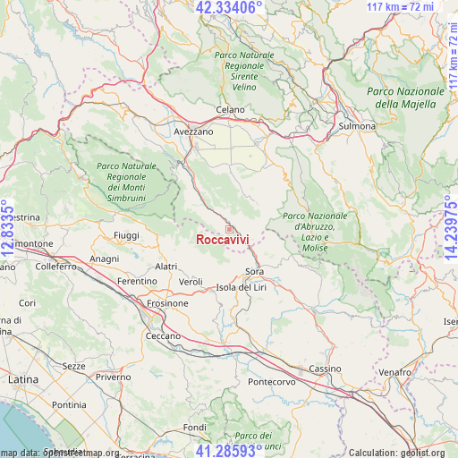
| Upper-left | 42.33406°, | 12.8335° |
| Center: | 41.81214°, | 13.53662° |
| Lower-right: | 41.28593°, | 14.23975° |
| Map W x H: | 116.5×116.5 km | = 72.4×72.4mi |
| max Lat: | 47.04031° ⇑71.9% North |
| Roccavivi: | 41.81214° |
| min Lat: | ⇓28.1% South 35.50142° |
| min Long | Roccavivi | max Long |
| 6.69888° | 13.53662° | 18.48682° |
| W 74%⇐ | ⇒26% E |
Elevation
Elevation of Roccavivi is 474 m = 1555 ft, and this is 167.3 m = 549 ft above average elevation for this country.
| Max E: |
2085 m = 6841 ft | 23.4% |
| Roccavivi | 474 m 1555 ft | |
| Avg. | 306.7 m = 1006 ft | |
Min E: |
-4 m = -13 ft | 76.6% |
See also: Italy elevation on elevation.city.
Geographical zone
Roccavivi is located in North temperate zone (between Tropic of Cancer and the Arctic Circle). Distance of this Northern Tropic circle is 2043.2 km =1269.6 mi to South.| Distance of | km | miles | from Roccavivi |
|---|---|---|---|
| North Pole | 5358 | 3329.3 | to North |
| Arctic Circle | 2752.1 | 1710.1 | to North |
| Tropic Cancer | 2043.2 | 1269.6 | to South |
| Equator | 4649.1 | 2888.8 | to South |


Nearby cities:
15 places around Roccavivi: (largest is in red/bold)
• Balsorano
1.9 km =1.2 mi,  97°
97°
• Balsorano Nuovo
2 km =1.2 mi, 100°
• Case Cibba-Sciascia-Crocifisso-Tondarella-Virano
14.7 km =9.1 mi,  218°
218°
• Civita d'Antino
9.8 km =6.1 mi,  327°
327°
• Civitella Roveto
14.6 km =9.1 mi,  320°
320°
• Collelongo
9.2 km =5.7 mi,  25°
25°
• La Grancia
10.2 km =6.3 mi,  302°
302°
• Morino
8.8 km =5.5 mi,  311°
311°
• Pescosolido
12.2 km =7.6 mi,  125°
125°
• Ridotti
6.4 km =4 mi,  115°
115°
• San Vincenzo Valle Roveto
3.6 km =2.2 mi,  358°
358°
• San Vincenzo Valle Roveto Superiore
2.6 km =1.6 mi,  335°
335°
• Santa Francesca
12.6 km =7.8 mi,  213°
213°
• Sora
12.2 km =7.6 mi,  148°
148°
• Villavallelonga
9.6 km =6 mi,  46°
46°
Sources, notices
• [Note1] Compared only with cities in Italy existing in our database
• [Src1] Map data: © OpenStreetMap contributors (CC-BY-SA)
• [Src2] Other city data from geonames.org with taken over terms of usage.
• [Src3] Geographical zone / Annual Mean Temperature by Robert A. Rohde @ Wikipedia
