San Vincenzo Valle Roveto geodata
San Vincenzo Valle Roveto (Abruzzo) is a seat of a third-order administrative division; located in Italy in Europe/Rome (GMT+2) time zone. With population of 213 people, there are 11065 cities with bigger population in this country. Compared to other cities in Italy, 71.7% of cities are located further ↑North; 74% of cities are located further ←West and 82.7% of cities have lower elevation than San Vincenzo Valle Roveto. Note1
Administrative division(s):
- Level 1: Abruzzo
- Level 2: Provincia dell' Aquila
- Level 3: San Vincenzo Valle Roveto
Current local time in San Vincenzo Valle Roveto:
11:48 PM, WednesdayDifference from your time zone: hours


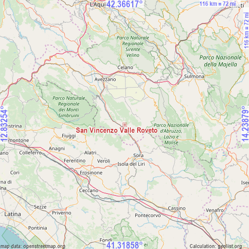
San Vincenzo Valle Roveto GPS coordinates[2]
41° 50' 40.272" North, 13° 32' 8.376" East
| Map corner | latitude | longitude |
|---|---|---|
| Upper-left | 42.36617°, | 12.83254° |
| Center: | 41.84452°, | 13.53566° |
| Lower-right: | 41.31858°, | 14.23879° |
| Map W x H: | 116.5×116.5 km | = 72.4×72.4mi |
| max Lat: | 47.04031° ⇑71.7% North |
| San Vincenzo Valle Roveto: | 41.84452° |
| min Lat: | ⇓28.3% South 35.50142° |
| min Long | San Vincenzo Va | max Long |
| 6.69888° | 13.53566° | 18.48682° |
| W 74%⇐ | ⇒26% E |
Elevation
Elevation of San Vincenzo Valle Roveto is 568 m = 1864 ft, and this is 261.3 m = 857 ft above average elevation for this country.
| Max E: |
2085 m = 6841 ft | 17.3% |
| San Vincenzo Valle Roveto | 568 m 1864 ft | |
| Avg. | 306.7 m = 1006 ft | |
Min E: |
-4 m = -13 ft | 82.7% |
See also: Italy elevation on elevation.city.
Geographical zone
San Vincenzo Valle Roveto is located in North temperate zone (between Tropic of Cancer and the Arctic Circle). Distance of this Northern Tropic circle is 2046.8 km =1271.8 mi to South.| Distance of | km | miles | from San Vincenzo Valle Roveto |
|---|---|---|---|
| North Pole | 5354.4 | 3327.1 | to North |
| Arctic Circle | 2748.5 | 1707.8 | to North |
| Tropic Cancer | 2046.8 | 1271.8 | to South |
| Equator | 4652.7 | 2891.1 | to South |


Nearby cities:
15 places around San Vincenzo Valle Roveto: (largest is in red/bold)
• Balsorano
4.3 km =2.7 mi,  152°
152°
• Balsorano Nuovo
4.5 km =2.8 mi, 152°
• Canistro Inferiore
14.8 km =9.2 mi,  316°
316°
• Civita d'Antino
7 km =4.3 mi,  311°
311°
• Civitella Roveto
12 km =7.5 mi, 309°
• Collelongo
6.1 km =3.8 mi,  40°
40°
• La Grancia
8.7 km =5.4 mi,  282°
282°
• Luco dei Marsi
13.8 km =8.6 mi,  338°
338°
• Morino
6.9 km =4.3 mi,  288°
288°
• Pescosolido
14.7 km =9.1 mi,  136°
136°
• Ridotti
8.6 km =5.3 mi, 137°
• Roccavivi
3.6 km =2.2 mi,  178°
178°
• San Vincenzo Valle Roveto Superiore
1.6 km =1 mi,  219°
219°
• Trasacco
12.6 km =7.8 mi,  358°
358°
• Villavallelonga
7.6 km =4.7 mi,  67°
67°
Sources, notices
• [Note1] Compared only with cities in Italy existing in our database
• [Src1] Map data: © OpenStreetMap contributors (CC-BY-SA)
• [Src2] Other city data from geonames.org with taken over terms of usage.
• [Src3] Geographical zone / Annual Mean Temperature by Robert A. Rohde @ Wikipedia
