Ridotti geodata
Ridotti (Abruzzo) is a populated place; located in Italy in Europe/Rome (GMT+1) time zone. With population of 560 people, there are 9347 cities with bigger population in this country. Compared to other cities in Italy, 72.1% of cities are located further ↑North; 74.7% of cities are located further ←West and 82.5% of cities have lower elevation than Ridotti. Note1


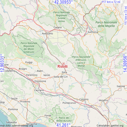
Ridotti GPS coordinates[2]
41° 47' 14.676" North, 13° 36' 23.148" East
| Map corner | latitude | longitude |
|---|---|---|
| Upper-left | 42.30953°, | 12.90331° |
| Center: | 41.78741°, | 13.60643° |
| Lower-right: | 41.261°, | 14.30956° |
| Map W x H: | 116.6×116.6 km | = 72.5×72.5mi |
| max Lat: | 47.04031° ⇑72.1% North |
| Ridotti: | 41.78741° |
| min Lat: | ⇓27.9% South 35.50142° |
| min Long | Ridotti | max Long |
| 6.69888° | 13.60643° | 18.48682° |
| W 74.7%⇐ | ⇒25.3% E |
Elevation
Elevation of Ridotti is 563 m = 1847 ft, and this is 256.3 m = 841 ft above average elevation for this country.
| Max E: |
2085 m = 6841 ft | 17.5% |
| Ridotti | 563 m 1847 ft | |
| Avg. | 306.7 m = 1006 ft | |
Min E: |
-4 m = -13 ft | 82.5% |
See also: Italy elevation on elevation.city.
Geographical zone
Ridotti is located in North temperate zone (between Tropic of Cancer and the Arctic Circle). Distance of this Northern Tropic circle is 2040.4 km =1267.8 mi to South.| Distance of | km | miles | from Ridotti |
|---|---|---|---|
| North Pole | 5360.7 | 3331 | to North |
| Arctic Circle | 2754.8 | 1711.8 | to North |
| Tropic Cancer | 2040.4 | 1267.8 | to South |
| Equator | 4646.3 | 2887.1 | to South |


Nearby cities:
15 places around Ridotti: (largest is in red/bold)
• Balsorano
4.6 km =2.9 mi,  302°
302°
• Balsorano Nuovo
4.5 km =2.8 mi, 302°
• Broccostella
10 km =6.2 mi,  166°
166°
• Campoli Appennino
8.6 km =5.3 mi,  132°
132°
• Carnello
11.6 km =7.2 mi,  178°
178°
• Castelliri
13.4 km =8.3 mi,  204°
204°
• Collelongo
11.2 km =7 mi,  350°
350°
• Isola del Liri
11.2 km =7 mi, 184°
• Pescosolido
6 km =3.7 mi,  135°
135°
• Posta Fibreno
12.3 km =7.6 mi,  150°
150°
• Roccavivi
6.4 km =4 mi, 295°
• San Vincenzo Valle Roveto
8.6 km =5.3 mi,  317°
317°
• San Vincenzo Valle Roveto Superiore
8.6 km =5.3 mi,  306°
306°
• Sora
7.7 km =4.8 mi, 175°
• Villavallelonga
9.4 km =5.8 mi,  7°
7°
Sources, notices
• [Note1] Compared only with cities in Italy existing in our database
• [Src1] Map data: © OpenStreetMap contributors (CC-BY-SA)
• [Src2] Other city data from geonames.org with taken over terms of usage.
• [Src3] Geographical zone / Annual Mean Temperature by Robert A. Rohde @ Wikipedia
