Roccadaspide geodata
Roccadaspide (Campania) is a seat of a third-order administrative division; located in Italy in Europe/Rome (GMT+2) time zone. With population of 2,686 people, there are 3324 cities with bigger population in this country. Compared to other cities in Italy, 84.6% of cities are located further ↑North; 88.8% of cities are located further ←West and 69.6% of cities have lower elevation than Roccadaspide. Note1


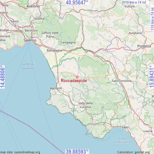
Roccadaspide GPS coordinates[2]
40° 25' 23.988" North, 15° 11' 28.248" East
| Map corner | latitude | longitude |
|---|---|---|
| Upper-left | 40.95647°, | 14.48806° |
| Center: | 40.42333°, | 15.19118° |
| Lower-right: | 39.88593°, | 15.89431° |
| Map W x H: | 119×119 km | = 73.9×73.9mi |
| max Lat: | 47.04031° ⇑84.6% North |
| Roccadaspide: | 40.42333° |
| min Lat: | ⇓15.4% South 35.50142° |
| min Long | Roccadaspide | max Long |
| 6.69888° | 15.19118° | 18.48682° |
| W 88.8%⇐ | ⇒11.2% E |
Elevation
Elevation of Roccadaspide is 390 m = 1280 ft, and this is 83.3 m = 273 ft above average elevation for this country.
| Max E: |
2085 m = 6841 ft | 30.4% |
| Roccadaspide | 390 m 1280 ft | |
| Avg. | 306.7 m = 1006 ft | |
Min E: |
-4 m = -13 ft | 69.6% |
See also: Italy elevation on elevation.city.
Geographical zone
Roccadaspide is located in North temperate zone (between Tropic of Cancer and the Arctic Circle). Distance of this Northern Tropic circle is 1888.7 km =1173.6 mi to South.| Distance of | km | miles | from Roccadaspide |
|---|---|---|---|
| North Pole | 5512.4 | 3425.2 | to North |
| Arctic Circle | 2906.5 | 1806 | to North |
| Tropic Cancer | 1888.7 | 1173.6 | to South |
| Equator | 4494.7 | 2792.9 | to South |


Nearby cities:
15 places around Roccadaspide: (largest is in red/bold)
• Albanella
9 km =5.6 mi,  313°
313°
• Altavilla Silentina
12.9 km =8 mi,  336°
336°
• Aquara
5.8 km =3.6 mi,  66°
66°
• Bellosguardo
10.2 km =6.3 mi,  90°
90°
• Capaccio
9.4 km =5.8 mi,  270°
270°
• Castel San Lorenzo
2.9 km =1.8 mi,  97°
97°
• Castelcivita
8.6 km =5.3 mi,  24°
24°
• Cicerale
10.2 km =6.3 mi,  210°
210°
• Controne
9.7 km =6 mi,  6°
6°
• Felitto
7.1 km =4.4 mi,  141°
141°
• Giungano
7.7 km =4.8 mi,  245°
245°
• Magliano Vetere
9.3 km =5.8 mi,  155°
155°
• Monteforte Cilento
6.5 km =4 mi,  177°
177°
• Ottati
11.4 km =7.1 mi, 67°
• Trentinara
6.9 km =4.3 mi, 247°
Sources, notices
• [Note1] Compared only with cities in Italy existing in our database
• [Src1] Map data: © OpenStreetMap contributors (CC-BY-SA)
• [Src2] Other city data from geonames.org with taken over terms of usage.
• [Src3] Geographical zone / Annual Mean Temperature by Robert A. Rohde @ Wikipedia
