Roccacasale geodata
Roccacasale (Abruzzo) is a seat of a third-order administrative division; located in Italy in Europe/Rome (GMT+2) time zone. With population of 566 people, there are 9291 cities with bigger population in this country. Compared to other cities in Italy, 69.3% of cities are located further ↑North; 77.4% of cities are located further ←West and 70.9% of cities have lower elevation than Roccacasale. Note1


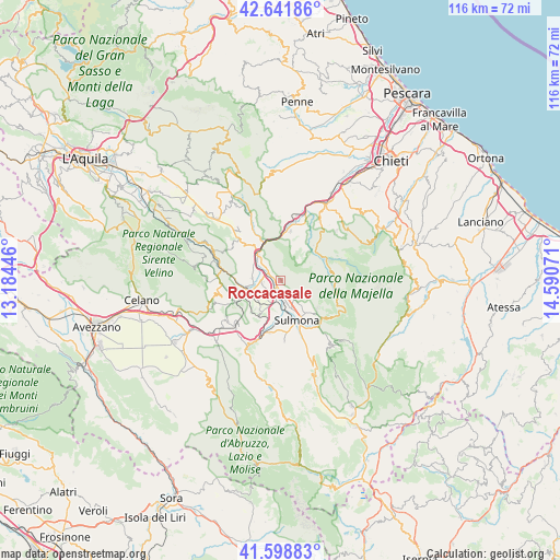
Roccacasale GPS coordinates[2]
42° 7' 20.964" North, 13° 53' 15.288" East
| Map corner | latitude | longitude |
|---|---|---|
| Upper-left | 42.64186°, | 13.18446° |
| Center: | 42.12249°, | 13.88758° |
| Lower-right: | 41.59883°, | 14.59071° |
| Map W x H: | 116×116 km | = 72.1×72.1mi |
| max Lat: | 47.04031° ⇑69.3% North |
| Roccacasale: | 42.12249° |
| min Lat: | ⇓30.7% South 35.50142° |
| min Long | Roccacasale | max Long |
| 6.69888° | 13.88758° | 18.48682° |
| W 77.4%⇐ | ⇒22.6% E |
Elevation
Elevation of Roccacasale is 403 m = 1322 ft, and this is 96.3 m = 316 ft above average elevation for this country.
| Max E: |
2085 m = 6841 ft | 29.1% |
| Roccacasale | 403 m 1322 ft | |
| Avg. | 306.7 m = 1006 ft | |
Min E: |
-4 m = -13 ft | 70.9% |
See also: Italy elevation on elevation.city.
Geographical zone
Roccacasale is located in North temperate zone (between Tropic of Cancer and the Arctic Circle). Distance of this Northern Tropic circle is 2077.7 km =1291 mi to South.| Distance of | km | miles | from Roccacasale |
|---|---|---|---|
| North Pole | 5323.5 | 3307.9 | to North |
| Arctic Circle | 2717.6 | 1688.6 | to North |
| Tropic Cancer | 2077.7 | 1291 | to South |
| Equator | 4683.6 | 2910.3 | to South |


Nearby cities:
15 places around Roccacasale: (largest is in red/bold)
• Badia
4.4 km =2.7 mi,  145°
145°
• Bugnara
11.2 km =7 mi,  191°
191°
• Bussi sul Tirino
11.3 km =7 mi,  332°
332°
• Caramanico Terme
10.4 km =6.5 mi,  68°
68°
• Corfinio
4 km =2.5 mi,  268°
268°
• Goriano Sicoli
10.4 km =6.5 mi,  243°
243°
• Marane
8.2 km =5.1 mi,  142°
142°
• Popoli
7 km =4.3 mi,  317°
317°
• Pratola Peligna
3 km =1.9 mi,  200°
200°
• Prezza
8.4 km =5.2 mi,  210°
210°
• Raiano
6.5 km =4 mi,  249°
249°
• Salle
8.6 km =5.3 mi,  44°
44°
• Sulmona
8.7 km =5.4 mi,  158°
158°
• Tocco da Casauria
10.2 km =6.3 mi,  12°
12°
• Vittorito
5.9 km =3.7 mi, 274°
Sources, notices
• [Note1] Compared only with cities in Italy existing in our database
• [Src1] Map data: © OpenStreetMap contributors (CC-BY-SA)
• [Src2] Other city data from geonames.org with taken over terms of usage.
• [Src3] Geographical zone / Annual Mean Temperature by Robert A. Rohde @ Wikipedia
