Castellazzo geodata
Castellazzo (Lombardy) is a populated place; located in Italy in Europe/Rome (GMT+2) time zone. With population of 800 people, there are 7640 cities with bigger population in this country. Compared to other cities in Italy, 72.6% of cities are located further ↓South; 82% of cities are located further →East and 63.3% of cities have higher elevation than Castellazzo. Note1
Administrative division(s):
- Level 1: Lombardy
- Level 2: Città metropolitana di Milano
- Level 3: Corbetta


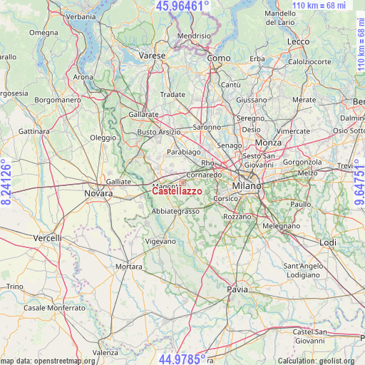
Castellazzo GPS coordinates[2]
45° 28' 25.356" North, 8° 56' 39.768" East
| Map corner | latitude | longitude |
|---|---|---|
| Upper-left | 45.96461°, | 8.24126° |
| Center: | 45.47371°, | 8.94438° |
| Lower-right: | 44.9785°, | 9.64751° |
| Map W x H: | 109.6×109.6 km | = 68.1×68.1mi |
| max Lat: | 47.04031° ⇑27.4% North |
| Castellazzo: | 45.47371° |
| min Lat: | ⇓72.6% South 35.50142° |
| min Long | Castellazzo | max Long |
| 6.69888° | 8.94438° | 18.48682° |
| W 18%⇐ | ⇒82% E |
Elevation
Elevation of Castellazzo is 139 m = 456 ft, and this is 167.7 m = 550 ft below average elevation for this country.
| Max E: |
2085 m = 6841 ft | 63.3% |
| Avg. | 306.7 m = 1006 ft | |
| Castellazzo | 139 m = 456 ft | |
Min E: |
-4 m = -13 ft | 36.7% |
See also: Italy elevation on elevation.city.
Geographical zone
Castellazzo is located in North temperate zone (between Tropic of Cancer and the Arctic Circle). Distance of this North polar circle is 2345 km =1457.1 mi to North.| Distance of | km | miles | from Castellazzo |
|---|---|---|---|
| North Pole | 4950.9 | 3076.3 | to North |
| Arctic Circle | 2345 | 1457.1 | to North |
| Tropic Cancer | 2450.3 | 1522.5 | to South |
| Equator | 5056.2 | 3141.8 | to South |


Nearby cities:
15 places around Castellazzo: (largest is in red/bold)
• Albairate
6 km =3.7 mi,  185°
185°
• Arluno
3.3 km =2.1 mi,  357°
357°
• Bareggio
4.2 km =2.6 mi,  81°
81°
• Castellazzo de' Barzi
4.9 km =3 mi,  225°
225°
• Cerello-Battuello
3.1 km =1.9 mi,  199°
199°
• Cisliano
4.7 km =2.9 mi,  135°
135°
• Corbetta
2.1 km =1.3 mi,  250°
250°
• Magenta
4.8 km =3 mi,  257°
257°
• Mantegazza
4.6 km =2.9 mi,  29°
29°
• Marcallo
5.7 km =3.5 mi,  280°
280°
• Ossona
5.5 km =3.4 mi,  312°
312°
• Rogorotto
4.1 km =2.5 mi, 28°
• Santo Stefano Ticino
2.6 km =1.6 mi,  302°
302°
• Sedriano
2.9 km =1.8 mi,  47°
47°
• Vittuone
1.7 km =1.1 mi,  19°
19°
Sources, notices
• [Note1] Compared only with cities in Italy existing in our database
• [Src1] Map data: © OpenStreetMap contributors (CC-BY-SA)
• [Src2] Other city data from geonames.org with taken over terms of usage.
• [Src3] Geographical zone / Annual Mean Temperature by Robert A. Rohde @ Wikipedia
