Rivergaro geodata
Rivergaro (Emilia-Romagna) is a seat of a third-order administrative division; located in Italy in Europe/Rome (GMT+2) time zone. With population of 3,762 people, there are 2528 cities with bigger population in this country. Compared to other cities in Italy, 58.2% of cities are located further ↓South; 71.9% of cities are located further →East and 62.6% of cities have higher elevation than Rivergaro. Note1
Administrative division(s):
- Level 1: Emilia-Romagna
- Level 2: Provincia di Piacenza
- Level 3: Rivergaro


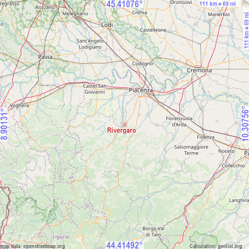
Rivergaro GPS coordinates[2]
44° 54' 54" North, 9° 36' 15.948" East
| Map corner | latitude | longitude |
|---|---|---|
| Upper-left | 45.41076°, | 8.90131° |
| Center: | 44.915°, | 9.60443° |
| Lower-right: | 44.41492°, | 10.30756° |
| Map W x H: | 110.7×110.7 km | = 68.8×68.8mi |
| max Lat: | 47.04031° ⇑41.8% North |
| Rivergaro: | 44.915° |
| min Lat: | ⇓58.2% South 35.50142° |
| min Long | Rivergaro | max Long |
| 6.69888° | 9.60443° | 18.48682° |
| W 28.1%⇐ | ⇒71.9% E |
Elevation
Elevation of Rivergaro is 144 m = 472 ft, and this is 162.7 m = 534 ft below average elevation for this country.
| Max E: |
2085 m = 6841 ft | 62.6% |
| Avg. | 306.7 m = 1006 ft | |
| Rivergaro | 144 m = 472 ft | |
Min E: |
-4 m = -13 ft | 37.4% |
See also: Italy elevation on elevation.city.
Geographical zone
Rivergaro is located in North temperate zone (between Tropic of Cancer and the Arctic Circle). Distance of this Northern Tropic circle is 2388.2 km =1484 mi to South.| Distance of | km | miles | from Rivergaro |
|---|---|---|---|
| North Pole | 5013 | 3114.9 | to North |
| Arctic Circle | 2407.1 | 1495.7 | to North |
| Tropic Cancer | 2388.2 | 1484 | to South |
| Equator | 4994.1 | 3103.2 | to South |


Nearby cities:
15 places around Rivergaro: (largest is in red/bold)
• Agazzano
7.6 km =4.7 mi,  298°
298°
• Gazzola
6.6 km =4.1 mi,  318°
318°
• Gossolengo
9.8 km =6.1 mi,  6°
6°
• Gragnano Trebbiense
11.1 km =6.9 mi,  346°
346°
• Niviano
3.4 km =2.1 mi,  34°
34°
• Piozzano
8.6 km =5.3 mi,  277°
277°
• Pittolo
11.9 km =7.4 mi,  22°
22°
• Podenzano
7.6 km =4.7 mi,  54°
54°
• Ponte dell'Olio
6.1 km =3.8 mi,  149°
149°
• Quarto
10.2 km =6.3 mi, 27°
• San Giorgio Piacentino
11.3 km =7 mi,  68°
68°
• San Polo
12.9 km =8 mi,  56°
56°
• Settima
7.6 km =4.7 mi, 31°
• Travo
7.5 km =4.7 mi,  219°
219°
• Vigolzone
5 km =3.1 mi,  91°
91°
Sources, notices
• [Note1] Compared only with cities in Italy existing in our database
• [Src1] Map data: © OpenStreetMap contributors (CC-BY-SA)
• [Src2] Other city data from geonames.org with taken over terms of usage.
• [Src3] Geographical zone / Annual Mean Temperature by Robert A. Rohde @ Wikipedia
