Podenzano geodata
Podenzano (Emilia-Romagna) is a seat of a third-order administrative division; located in Italy in Europe/Rome (GMT+2) time zone. With population of 5,901 people, there are 1663 cities with bigger population in this country. Compared to other cities in Italy, 59% of cities are located further ↓South; 70.9% of cities are located further →East and 66.2% of cities have higher elevation than Podenzano. Note1
Administrative division(s):
- Level 1: Emilia-Romagna
- Level 2: Provincia di Piacenza
- Level 3: Podenzano


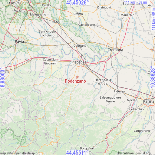
Podenzano GPS coordinates[2]
44° 57' 17.424" North, 9° 40' 59.34" East
| Map corner | latitude | longitude |
|---|---|---|
| Upper-left | 45.45026°, | 8.98003° |
| Center: | 44.95484°, | 9.68315° |
| Lower-right: | 44.45511°, | 10.38628° |
| Map W x H: | 110.7×110.6 km | = 68.8×68.7mi |
| max Lat: | 47.04031° ⇑41% North |
| Podenzano: | 44.95484° |
| min Lat: | ⇓59% South 35.50142° |
| min Long | Podenzano | max Long |
| 6.69888° | 9.68315° | 18.48682° |
| W 29.1%⇐ | ⇒70.9% E |
Elevation
Elevation of Podenzano is 120 m = 394 ft, and this is 186.7 m = 613 ft below average elevation for this country.
| Max E: |
2085 m = 6841 ft | 66.2% |
| Avg. | 306.7 m = 1006 ft | |
| Podenzano | 120 m = 394 ft | |
Min E: |
-4 m = -13 ft | 33.8% |
See also: Italy elevation on elevation.city.
Geographical zone
Podenzano is located in North temperate zone (between Tropic of Cancer and the Arctic Circle). Distance of this Northern Tropic circle is 2392.6 km =1486.7 mi to South.| Distance of | km | miles | from Podenzano |
|---|---|---|---|
| North Pole | 5008.6 | 3112.2 | to North |
| Arctic Circle | 2402.7 | 1493 | to North |
| Tropic Cancer | 2392.6 | 1486.7 | to South |
| Equator | 4998.5 | 3105.9 | to South |


Nearby cities:
15 places around Podenzano: (largest is in red/bold)
• Carpaneto Piacentino
9.4 km =5.8 mi,  119°
119°
• Gazzola
10.6 km =6.6 mi,  273°
273°
• Gossolengo
7.4 km =4.6 mi,  315°
315°
• Gragnano Trebbiense
10.9 km =6.8 mi,  305°
305°
• Niviano
4.6 km =2.9 mi,  249°
249°
• Piacenza
10.9 km =6.8 mi,  4°
4°
• Pittolo
6.7 km =4.2 mi,  346°
346°
• Ponte dell'Olio
10.2 km =6.3 mi,  197°
197°
• Pontenure
9.8 km =6.1 mi,  60°
60°
• Quarto
4.9 km =3 mi,  341°
341°
• Rivergaro
7.6 km =4.7 mi,  234°
234°
• San Giorgio Piacentino
4.3 km =2.7 mi,  94°
94°
• San Polo
5.2 km =3.2 mi, 59°
• Settima
3.1 km =1.9 mi, 311°
• Vigolzone
4.7 km =2.9 mi,  194°
194°
Sources, notices
• [Note1] Compared only with cities in Italy existing in our database
• [Src1] Map data: © OpenStreetMap contributors (CC-BY-SA)
• [Src2] Other city data from geonames.org with taken over terms of usage.
• [Src3] Geographical zone / Annual Mean Temperature by Robert A. Rohde @ Wikipedia
