Recoaro Terme geodata
Recoaro Terme (Veneto) is a seat of a third-order administrative division; located in Italy in Europe/Rome (GMT+2) time zone. With population of 3,259 people, there are 2865 cities with bigger population in this country. Compared to other cities in Italy, 81.4% of cities are located further ↓South; 54.1% of cities are located further →East and 75.3% of cities have lower elevation than Recoaro Terme. Note1


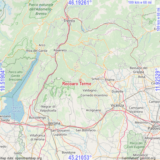
Recoaro Terme GPS coordinates[2]
45° 42' 13.428" North, 11° 13' 19.776" East
| Map corner | latitude | longitude |
|---|---|---|
| Upper-left | 46.19261°, | 10.51904° |
| Center: | 45.70373°, | 11.22216° |
| Lower-right: | 45.21053°, | 11.92529° |
| Map W x H: | 109.2×109.2 km | = 67.9×67.9mi |
| max Lat: | 47.04031° ⇑18.6% North |
| Recoaro Terme: | 45.70373° |
| min Lat: | ⇓81.4% South 35.50142° |
| min Long | Recoaro Terme | max Long |
| 6.69888° | 11.22216° | 18.48682° |
| W 45.9%⇐ | ⇒54.1% E |
Elevation
Elevation of Recoaro Terme is 456 m = 1496 ft, and this is 149.3 m = 490 ft above average elevation for this country.
| Max E: |
2085 m = 6841 ft | 24.7% |
| Recoaro Terme | 456 m 1496 ft | |
| Avg. | 306.7 m = 1006 ft | |
Min E: |
-4 m = -13 ft | 75.3% |
See also: Italy elevation on elevation.city.
Geographical zone
Recoaro Terme is located in North temperate zone (between Tropic of Cancer and the Arctic Circle). Distance of this North polar circle is 2319.4 km =1441.2 mi to North.| Distance of | km | miles | from Recoaro Terme |
|---|---|---|---|
| North Pole | 4925.3 | 3060.4 | to North |
| Arctic Circle | 2319.4 | 1441.2 | to North |
| Tropic Cancer | 2475.9 | 1538.5 | to South |
| Equator | 5081.8 | 3157.7 | to South |


Nearby cities:
15 places around Recoaro Terme: (largest is in red/bold)
• Altissimo
10.2 km =6.3 mi,  166°
166°
• Cornedo Vicentino
13 km =8.1 mi,  138°
138°
• Crespadoro
9.3 km =5.8 mi,  178°
178°
• Molino-Mozzi-Bittarelli
10.2 km =6.3 mi, 174°
• Monte di Malo
11.8 km =7.3 mi,  114°
114°
• Posina
10.2 km =6.3 mi,  17°
17°
• San Quirico
4.9 km =3 mi,  127°
127°
• San Vito di Leguzzano
13.1 km =8.1 mi,  99°
99°
• Santorso
13.3 km =8.3 mi,  75°
75°
• Schio
10.5 km =6.5 mi, 84°
• Selva di Progno
12.2 km =7.6 mi,  212°
212°
• Torrebelvicino
7.6 km =4.7 mi, 79°
• Valdagno
8.8 km =5.5 mi, 137°
• Vallarsa
11.9 km =7.4 mi,  317°
317°
• Valli del Pasubio
5.2 km =3.2 mi,  38°
38°
Sources, notices
• [Note1] Compared only with cities in Italy existing in our database
• [Src1] Map data: © OpenStreetMap contributors (CC-BY-SA)
• [Src2] Other city data from geonames.org with taken over terms of usage.
• [Src3] Geographical zone / Annual Mean Temperature by Robert A. Rohde @ Wikipedia
