Premeno geodata
Premeno (Piedmont) is a seat of a third-order administrative division; located in Italy in Europe/Rome (GMT+2) time zone. With population of 466 people, there are 10033 cities with bigger population in this country. Compared to other cities in Italy, 91.4% of cities are located further ↓South; 86.7% of cities are located further →East and 94.1% of cities have lower elevation than Premeno. Note1
Administrative division(s):
- Level 1: Piedmont
- Level 2: Provincia Verbano-Cusio-Ossola
- Level 3: Premeno


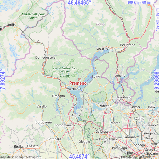
Premeno GPS coordinates[2]
45° 58' 41.448" North, 8° 35' 45.132" East
| Map corner | latitude | longitude |
|---|---|---|
| Upper-left | 46.46465°, | 7.89274° |
| Center: | 45.97818°, | 8.59587° |
| Lower-right: | 45.4874°, | 9.29899° |
| Map W x H: | 108.7×108.7 km | = 67.5×67.5mi |
| max Lat: | 47.04031° ⇑8.6% North |
| Premeno: | 45.97818° |
| min Lat: | ⇓91.4% South 35.50142° |
| min Long | Premeno | max Long |
| 6.69888° | 8.59587° | 18.48682° |
| W 13.3%⇐ | ⇒86.7% E |
Elevation
Elevation of Premeno is 839 m = 2753 ft, and this is 532.3 m = 1746 ft above average elevation for this country.
| Max E: |
2085 m = 6841 ft | 5.9% |
| Premeno | 839 m 2753 ft | |
| Avg. | 306.7 m = 1006 ft | |
Min E: |
-4 m = -13 ft | 94.1% |
See also: Italy elevation on elevation.city.
Geographical zone
Premeno is located in North temperate zone (between Tropic of Cancer and the Arctic Circle). Distance of this North polar circle is 2288.9 km =1422.3 mi to North.| Distance of | km | miles | from Premeno |
|---|---|---|---|
| North Pole | 4894.8 | 3041.5 | to North |
| Arctic Circle | 2288.9 | 1422.3 | to North |
| Tropic Cancer | 2506.4 | 1557.4 | to South |
| Equator | 5112.3 | 3176.6 | to South |


Nearby cities:
15 places around Premeno: (largest is in red/bold)
• Arizzano
2.5 km =1.6 mi,  203°
203°
• Aurano
2.5 km =1.6 mi,  346°
346°
• Bee
2.3 km =1.4 mi,  223°
223°
• Cambiasca
4.3 km =2.7 mi,  246°
246°
• Caprezzo
2.6 km =1.6 mi,  279°
279°
• Castelveccana
6.4 km =4 mi,  121°
121°
• Ghiffa
2.9 km =1.8 mi,  166°
166°
• Gonte
4.6 km =2.9 mi,  65°
65°
• Intragna
2.5 km =1.6 mi,  317°
317°
• Miazzina
5.6 km =3.5 mi,  267°
267°
• Oggebbio
4.2 km =2.6 mi, 70°
• Pallanza-Intra-Suna
4.9 km =3 mi, 203°
• San Bernardino Verbano
6.4 km =4 mi, 247°
• Santino
6.4 km =4 mi, 247°
• Vignone
3.1 km =1.9 mi,  232°
232°
Sources, notices
• [Note1] Compared only with cities in Italy existing in our database
• [Src1] Map data: © OpenStreetMap contributors (CC-BY-SA)
• [Src2] Other city data from geonames.org with taken over terms of usage.
• [Src3] Geographical zone / Annual Mean Temperature by Robert A. Rohde @ Wikipedia
